




DELMARVA - Residents and visitors across Sussex County, especially in beach towns like Rehoboth, Bethany, and Dewey Beach, should prepare for a stretch of damp and humid weather lasting through Thursday evening. A weak area of low pressure will remain nearly stationary over the Mid-Atlantic, supporting unsettled conditions across the region.
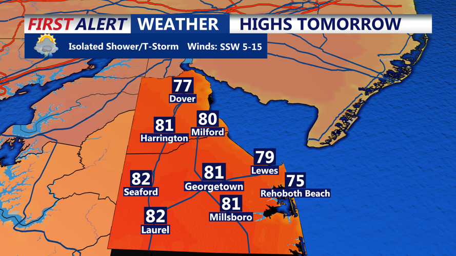
Through Thursday, skies will remain largely overcast with episodes of rain and drizzle, particularly during the day. While the heavier rainfall is expected to remain north of Delaware, isolated showers and thunderstorms are possible across the Delmarva Peninsula. Rainfall amounts will likely remain light to moderate, but brief downpours may occur. Daytime temperatures will hover in the low to mid 70s, accompanied by elevated humidity and light winds from the southeast.
By Thursday night, a temporary ridge of high pressure will build in, offering a brief reprieve from the dreary weather. Skies may partially clear across the county, and drier conditions are anticipated, though fog may develop again during the overnight hours. Lows will range from the upper 50s to the low 60s.
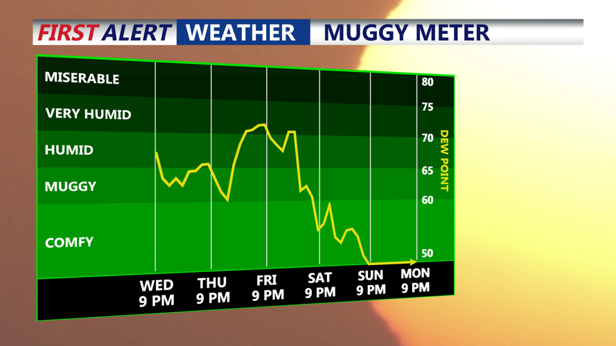
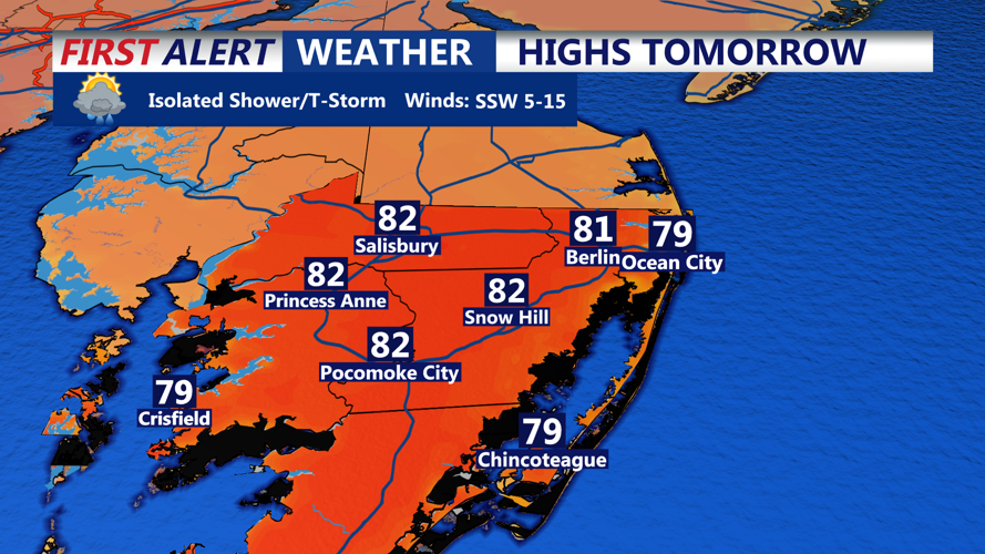
The coastal communities should enjoy a slightly more comfortable evening Thursday before conditions turn unsettled again on Friday. A warm front will lift northward in the morning, ushering in more humid air and potential showers. While Friday won't be a washout, scattered afternoon storms and temperatures climbing into the low 80s will signal a return to unsettled weather.
The pattern remains active into Saturday, when a strong cold front is expected to push through the region. Ahead of this front, temperatures will rise and humidity will peak, potentially fueling stronger thunderstorms by Saturday afternoon and evening. Forecasters are monitoring this system for the possibility of damaging winds and locally heavy rain.
A return to sunshine and drier, more seasonable conditions is forecast for Sunday and early next week as high pressure builds in behind the cold front.
