





Improving weather conditions are expected on Thursday as a Subtropical Storm Josephine moves farther into the Atlantic, although gusty winds, rough surf and lingering coastal flooding concerns will continue along Delaware's beaches.
Early Thursday morning will bring chilly temperatures and a persistent northerly breeze, particularly along coastal communities from Lewes and Rehoboth Beach south through Bethany Beach, Fenwick Island, and Ocean City. Winds will be noticeably lighter than Wednesday's peak gusts, but breezy conditions will continue throughout the day.
High pressure building southward from Canada will help push the offshore storm farther away from the Mid-Atlantic coast. However, the pressure difference between these weather systems will maintain north to northwest winds of 10 to 20 mph Thursday, with occasional gusts approaching 25 mph.
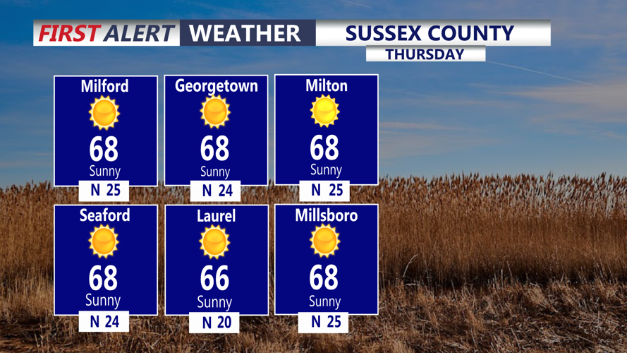
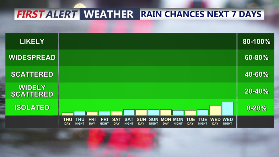
Skies will feature periods of sunshine and passing clouds, with dry conditions expected across inland communities including Georgetown, Millsboro, Seaford, Laurel, and Salisbury. The persistent breeze and influx of cooler air will give the region a distinctly autumnlike feel.
Along the beaches, large ocean waves and elevated water levels will remain concerns despite the improving weather. Wave heights offshore could reach 8 to 15 feet, with additional beach erosion possible, particularly around high tide.
A Small Craft Advisory remains in effect for the Atlantic coastal waters through Friday evening, while portions of lower Delaware Bay remain under an advisory through Thursday evening. Boaters should anticipate hazardous marine conditions due to rough seas and gusty winds.
Although the most widespread tidal flooding occurred Wednesday evening, another round of minor coastal flooding remains possible during Thursday evening's high tide. Flooding is expected to be more isolated and less significant as the offshore storm continues moving away.
By Thursday night, winds will gradually diminish as high pressure strengthens across the region. Skies will become partly cloudy to mostly clear, allowing temperatures to drop as colder and drier air settles over Sussex County.
Early Friday morning will bring chilly conditions, especially across inland communities where temperatures will fall more quickly than along the beaches. Widespread frost is not expected Thursday night, but a colder air mass arriving later Friday will increase the potential for frost Friday night into early Saturday.
Looking ahead, high pressure will dominate the weekend forecast, bringing generally dry weather, lighter winds and increasingly chilly nighttime temperatures. Inland locations could experience temperatures in the 30s Friday and Saturday nights, with frost possible and a few colder locations potentially approaching freezing.
Residents along the coastline should remain cautious near the surf and continue monitoring tidal conditions Thursday evening, while inland residents may want to prepare sensitive outdoor plants for colder temperatures heading into the weekend.
