


DELMARVA - Residents and beachgoers in Sussex County should prepare for a brief bout of unsettled weather late Monday night into Tuesday before conditions turn warmer and more tranquil midweek.
A warm front will lift northward into southern Delaware Monday evening, but no rain is expected with its passage. However, patchy marine clouds and mild temperatures—ranging from the upper 50s to upper 60s—will linger along the coast.
Early Tuesday morning, around 2 to 4 a.m., a stronger cold front will move in from the west, bringing with it scattered showers and a chance of embedded thunderstorms. The rain is expected to increase in coverage through Tuesday morning, especially in eastern and southeastern portions of the Delmarva Peninsula—including the beach towns of Lewes, Rehoboth Beach, Bethany Beach, and Fenwick Island.
Although the overall risk of severe weather is low, stronger storms may still develop, supported by moderate instability and favorable wind shear. The National Weather Service has placed much of the area under a marginal risk for excessive rainfall, with urban and poor drainage areas most at risk for localized flooding.
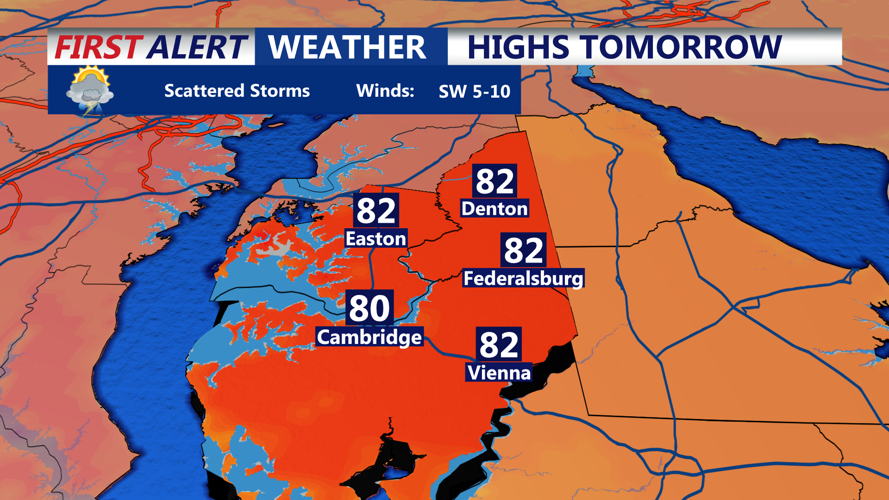
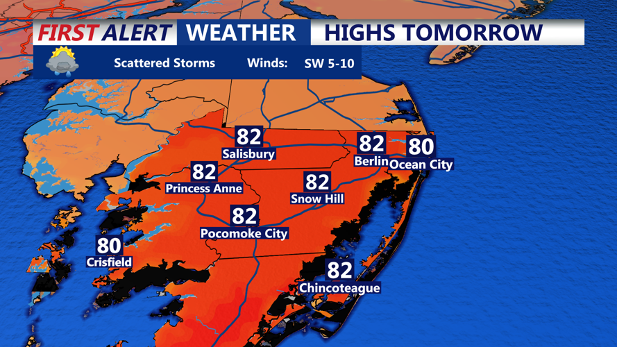
Tuesday will also feel humid, with daytime highs in the upper 70s to low 80s. Drier and more comfortable air will gradually move in behind the front by Tuesday evening.
By Tuesday night, skies clear and a period of high pressure sets in, ushering in quiet and seasonably warm conditions for the rest of the week. Lows will dip into the upper 50s to low 60s overnight Tuesday.
Wednesday and Thursday will feature sun-soaked skies and summerlike warmth. Highs are expected to climb into the low to mid-80s Wednesday and could reach the upper 80s in some areas by Thursday.
Looking ahead to Friday and the weekend, another cold front will push in from the north and stall over the area. Multiple waves of low pressure will ride along the front, leading to several periods of rain and isolated thunderstorms from Friday through early next week. While no severe weather or flooding is expected at this time, beach plans may need adjusting.
Beachgoers and coastal residents are advised to monitor the forecast closely as conditions evolve heading into the weekend.