


DELMARVA - A cold front sweeping across Sussex County late Sunday will bring an end to lingering showers, followed by clearing skies, brisk winds and a colder air mass that will set up a quiet but chilly Monday before a stronger storm system arrives Monday night into Tuesday.
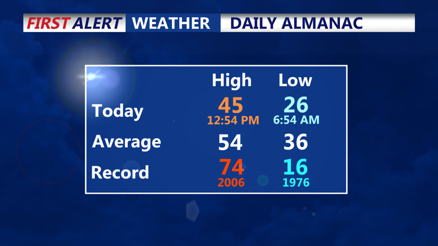
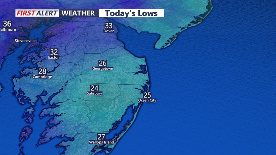
Light rainfall tapering off early this evening will leave behind low clouds and breezy south-southwest winds gusting up to twenty-five miles per hour. After the cold front moves through, skies will clear and winds will shift to the northwest overnight, with gusts reaching as high as thirty miles per hour as colder air funnels into the region. Temperatures will fall into the upper twenties to around thirty degrees by daybreak Monday.
Monday will start mostly clear and cold across Sussex County, with winds gradually easing through the afternoon as high pressure settles overhead. Highs will reach the mid-forties. Clouds will begin to increase late in the day ahead of a developing storm system that is expected to bring widespread precipitation Monday night into Tuesday. While northern parts of the region could begin with a brief period of light snow, Sussex County is expected to see mainly rain by Tuesday with temperatures climbing into the mid-forties to near fifty.