


DELMARVA - A blustery northwest wind will continue through late Thursday evening in Sussex County as high pressure edges in behind low pressure offshore, keeping a winter bite in the air.
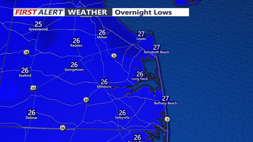
Skies are expected to stay partly to mostly cloudy through the evening before gradually clearing overnight. Temperatures will drop sharply, with lows dipping into the teens to lower 20s by early Friday.
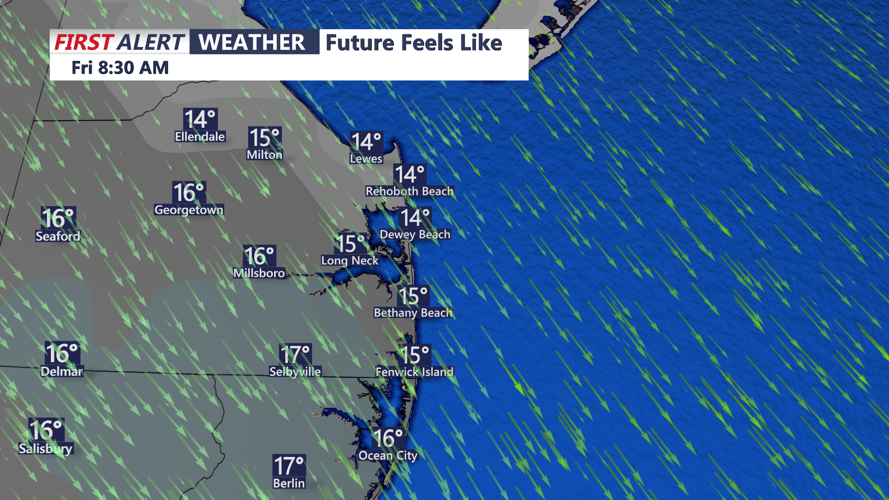
Friday brings a brighter day, with sunshine returning and afternoon highs generally in the 30s. Despite the sun, the air will remain colder than normal through Friday night.
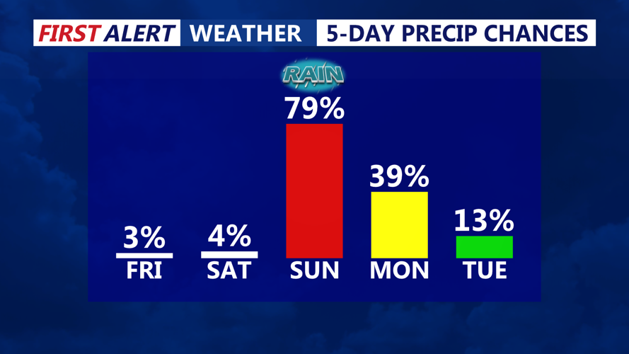
Looking beyond the immediate forecast, a fast-moving disturbance could trigger light snow showers late Friday night into early Saturday, mainly along and north of the Interstate 78 corridor — well north of Sussex County — with only minor, spotty accumulation possible where the snow is able to reach the ground. Farther out, forecast trends favor a weaker, more southerly track for a Sunday-to-Monday system, reducing the odds of significant impacts in the region, and another chance of rain may arrive with a system Wednesday into Thursday.