


DELMARVA - A cold front that initially moved offshore has paved the way for a secondary front now advancing toward Delmarva from central Pennsylvania. This front is currently generating some showers, with the potential for these to intensify into thunderstorms as they approach the region. The available instability, as indicated by mixed-layer CAPE values exceeding 1000 J/kg toward the east, suggests the possibility of stronger storms developing, particularly near the urban corridor. However, the overall severe weather threat is limited due to a lack of sufficient wind shear.
Despite this limitation, the Storm Prediction Center has placed Delmarva under a Marginal Risk for severe weather, meaning that while widespread severe storms are not anticipated, isolated instances of damaging winds and large hail are possible, particularly in the late afternoon and early evening.
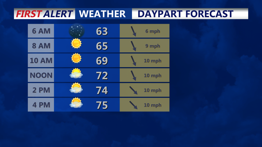
As the evening progresses, the cold front and associated thunderstorms will move offshore, bringing a swift end to the storm threat. In the wake of the front, a noticeable change in the air will follow, with dew points dropping rapidly as a refreshing northwesterly breeze ushers in much drier and cooler conditions. By tomorrow morning, residents across Delmarva can expect lows to dip into the 50s, with a few areas possibly holding in the lower 60s.
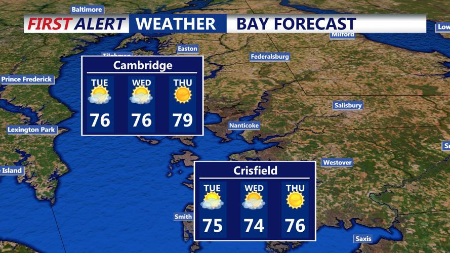
Tuesday will be a markedly cooler and more comfortable day, with highs only reaching the 70s across much of the region. Most areas near and northwest of the urban corridor will see temperatures in the low to mid-70s, while southern and eastern areas will experience mid to upper 70s. Dew points will remain low, in the 50s, ensuring a pleasant and crisp feel to the air throughout the day.
Residents should enjoy the comfortable weather, as it provides a refreshing break from the recent humidity and heat.