




DELMARVA - A noticeable cooldown will greet residents Thursday morning as cooler air settles across the region following Wednesday's unseasonably warm temperatures. The quieter weather will be short-lived, however, as another approaching storm system brings increasing chances for showers and thunderstorms Thursday night into early Friday.
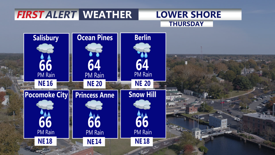
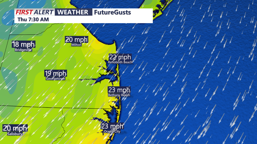
Thursday morning will begin with a mixture of clouds and sunshine, with temperatures generally in the upper 50s to lower 60s. Northeasterly to easterly winds will reinforce the cooler conditions, especially along the beaches from Lewes and Rehoboth Beach south through Bethany Beach, Fenwick Island and Ocean City.
Afternoon temperatures will struggle to climb beyond the lower to middle 60s, a dramatic change from Wednesday's highs in the upper 80s and near 90 degrees. The cooler conditions will be accompanied by variable cloud cover, although much of the day should remain dry.
A few isolated showers could develop late Thursday afternoon, as a stalled frontal boundary begins moving northward across the Delmarva Peninsula.
Clouds will increase Thursday evening as warmer and more humid air begins returning ahead of a powerful low-pressure system developing north of the region.
Showers will become more likely overnight Thursday into early Friday morning, with a few embedded thunderstorms possible. Although widespread severe weather is not expected during the overnight period, brief downpours and occasional lightning cannot be ruled out.
Overnight temperatures will generally remain in the upper 50s to lower 60s as southerly winds gradually develop ahead of the approaching system.
For coastal communities, marine conditions will require additional attention. Small Craft Advisories have been issued for Atlantic coastal waters from Cape May to Fenwick Island early Thursday morning as winds and seas become hazardous for smaller vessels.
Looking ahead, Friday will bring a significant change in weather as a powerful cold front approaches Delmarva. Temperatures could rebound into the 70s and lower 80s before the front arrives late Friday afternoon and evening.
A line of showers and thunderstorms could accompany the front between approximately 4 and 8 p.m., with some storms potentially producing damaging wind gusts.
Strong northwest winds will develop behind the front Friday night, with gusts of 30 to 40 mph possible into Saturday morning. A Gale Watch has been issued for Delaware Bay and Atlantic coastal waters Friday night through Saturday.
The coldest air of the season will follow this weekend, with Saturday highs only in the lower to middle 50s. Temperatures could fall into the 30s Saturday night, bringing the possibility of frost to some inland areas by early Sunday morning.
Residents should prepare for a sharp transition from Wednesday's summerlike warmth to autumn temperatures Thursday, followed by potentially stormy conditions Friday and a much colder weekend.
