



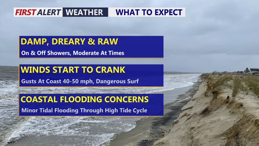
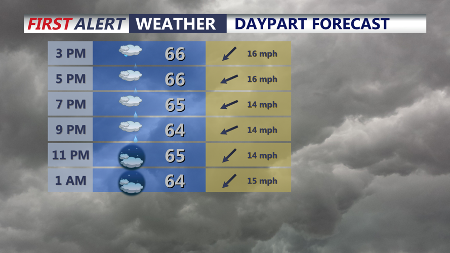

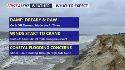
DELMARVA -- Nasty stretch of weather over the next few days with on and off showers and winds increasing especially at the coast. Expect showers to continue through Wednesday morning. Highs today stuck in the mid to upper 60s for most of us, low 70s southwest portion of the peninsula. Fall officially arrives at 8:05 PM.

On and off showers, damp and dreary day will continue into the night. Temperatures in the mid to upper 60s.
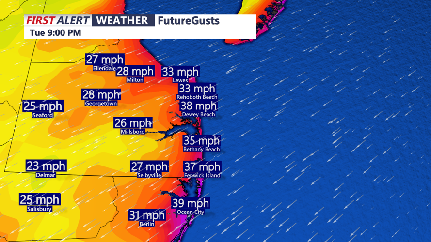
Winds will gust at the coast 35 to 45 mph out of the east northeast, 25 to 35 mph gusts further inland. Wind Advisory goes into effect for the Delaware Beaches from Wednesday 6AM-Midnight.

Winds will gust out of the east northeast 35 to 45 mph at the coast late today into tonight.
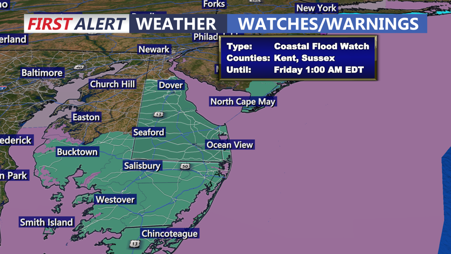
Minor coastal flooding is possible through this evenings high tide cycle, up to a foot of inundation in low lying areas is possible. A Coastal Flood Watch is up through Friday for all of Delmarva.

Coastal Flood Watch for all of Delmarva through Friday morning. Minor to significant tidal flooding possible through high tide cycles.
High Surf Advisory is up for the Delmarva coast through Friday, swells as high as 10 feet are possible Wednesday.
Tonight on and off showers continue and areas of drizzle will fall into the upper 50s to low 60s.
An area of low pressure off the Carolinas combined with a strong area of high pressure over Canada will produce continued strong winds at the coast with the tight pressure gradient. Showers will end Wednesday afternoon, clouds and windy conditions with highs in the mid to upper 60s. Winds could gust as high as 50 mph at the coast.
Trending drier Thursday and Friday with some isolated showers and drizzle possible primarily at the coast. But will continue to see persistent onshore winds out of the east northeast gusting 35 mph. Coastal flooding will continue to be a concern. Highs in the 60s to low 70s.
Uncertainty into the weekend as an area of low pressure will strengthen offshore, GFS American model takes the area of low pressure further east. This would bring dry conditions, with just breezy weather and coastal flooding concerns. The EURO model takes the storm further west and tucks the low into New England, this scenario would bring increasing rain, wind, coastal flooding and beach erosion.
Temperatures over the weekend will be in the upper 60s to low 70s. Heading into next week temperatures will rebound to seasonable levels back into the mid 70s.
