







DELMARVA - Sussex County will remain clear and warm late Tuesday night as heat and humidity continue building across southern Delaware. Overnight temperatures will only fall into the low to mid-70s, offering limited relief before the hottest conditions of the week arrive Wednesday.
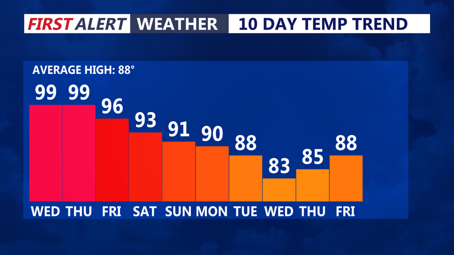
Wednesday will bring mostly sunny skies and dangerously hot conditions across the county. Afternoon temperatures are expected to reach the mid to upper 90s, including communities near the Delaware beaches.
A westerly wind of 10 to 15 mph will prevent the cooler ocean breeze from moving far inland. Even coastal communities such as Lewes, Rehoboth Beach, Bethany Beach and Fenwick Island could experience heat index values between 100 and 105 degrees.
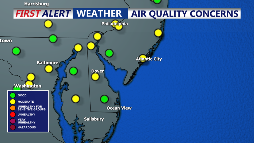
Smoke drifting south from Canadian wildfires could create hazy skies and slightly limit afternoon heating. However, the smoke will not provide meaningful relief from the dangerous combination of heat and humidity.
People working or spending time outdoors should take frequent breaks, drink plenty of water and avoid strenuous activity during the hottest part of the afternoon. Children and pets should never be left inside parked vehicles, even briefly.
A mostly dry cold front will approach Sussex County Wednesday evening. The front should gradually lower temperatures and humidity overnight, although above-normal temperatures are expected to continue through the end of the week.
The next significant chance for showers and thunderstorms is expected this weekend. Some storms could produce damaging winds, torrential rain and localized flash flooding.
