




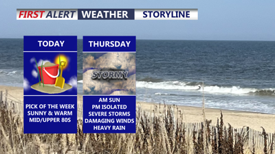
DELMARVA -- Today is the pick of the week across Delmarva as high pressure builds into the region, delivering plenty of sunshine, warm temperatures and slightly lower humidity.
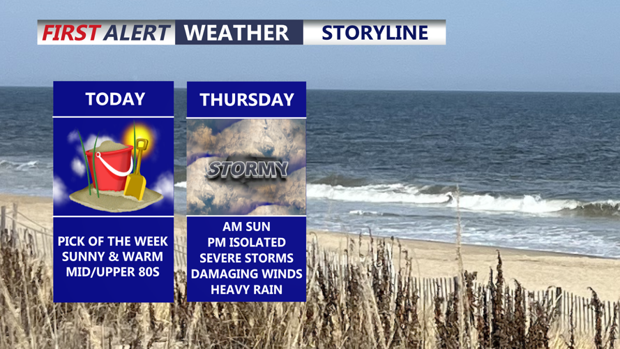
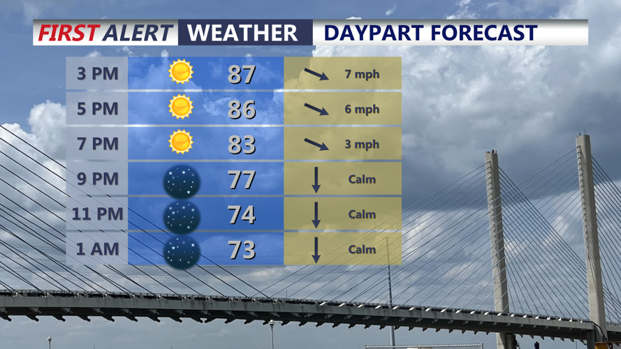
Wall-to-wall sunshine is expected through much of today, with highs reaching 85 to 90 degrees inland and 80 to 85 degrees at the beaches. The combination of dry weather and somewhat more comfortable humidity levels should make for an excellent late-summer day across the peninsula.

Sunny skies, highs in the mid to upper 80s, slightly lower humidity levels.
Tonight will remain mostly clear and pleasant, with temperatures falling into the upper 60s to low 70s. While conditions stay quiet for much of the night, changes will begin taking shape as a cold front slowly approaches Delmarva from the west.
An upper-level low will continue pivoting across portions of Ontario and Quebec through the end of the week, while broad troughing remains in place across the Northeast and Mid-Atlantic. Several smaller disturbances rotating through that trough will help support increasingly unsettled weather as the front moves closer.
Thursday brings the most significant weather concerns of the week.
Forecast guidance has generally slowed the eastward movement of the cold front, which could allow thunderstorms to develop in multiple rounds across Delmarva. Some showers may develop as early as Thursday morning, but the primary window for stronger storms and heavier rainfall appears to be Thursday afternoon and evening.
There remains some uncertainty in the exact timing of the front, but confidence is increasing that portions of Delmarva could face both severe thunderstorm and flash flooding concerns.
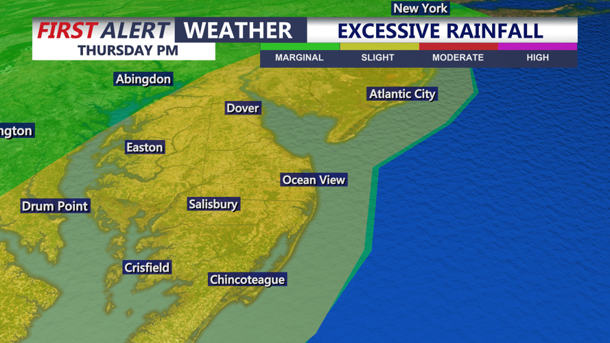
Atmospheric moisture will be unusually high, with precipitable water values projected around 2 to 2.3 inches. Thunderstorms will be capable of producing very heavy rainfall, with rates potentially reaching 2 to 3 inches per hour in the strongest downpours. The Weather Prediction Center has placed the area in a Slight Risk, level 2 of 4, for excessive rainfall.

SLIGHT risk (2 of 4) for excessive rainfall, storms could bring 2" to 3" per/hour rainfall rates.
The overall atmospheric setup may favor flooding concerns more than widespread severe weather, but strong to severe thunderstorms will still be possible. Moderate instability and sufficient wind shear could support organized storms, especially if lines or clusters develop to the west and move across Delmarva.

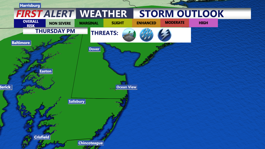
Marginal (1 of 5) risk for severe storms Thursday afternoon-evening, damaging winds (gusts 60 mph+) being the primary threat.
Damaging wind gusts would be the primary severe weather threat. The region is currently under a Marginal Risk, level 1 of 5, for severe thunderstorms, although an upgrade to a Slight Risk, level 2 of 5, could become possible if later forecast guidance continues to show a favorable setup for organized storms.
Highs Thursday will be in the mid to upper 80s. Will start with some sun in the morning to storms in the afternoon.
Residents should remain weather-aware Thursday, particularly during the afternoon and evening, as periods of torrential rain could quickly lead to poor drainage flooding and reduced visibility. Areas experiencing repeated thunderstorms would have the greatest risk for localized flash flooding.
Most of Friday is trending drier with mostly cloudy skies and highs in the upper 70s to low 80s. The weather pattern is expected to remain unsettled heading into Friday night and the weekend. Much will depend on where Thursday's cold front ultimately stalls. Current guidance suggests the boundary could linger over or near Delmarva while several areas of low pressure travel along it.
That setup would maintain daily chances for showers and thunderstorms through the weekend. Exact timing and placement remain uncertain, so rain is not expected to fall continuously, but periods of unsettled weather will remain possible each day.
Temperatures through the extended period should remain fairly typical for late August, although humidity levels could become uncomfortable at times.
There are signs of improvement farther down the road. High pressure is expected to begin nudging back toward the region next week, which should eventually help break the unsettled pattern and bring a return to more stable conditions across Delmarva into early next week.
