


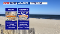


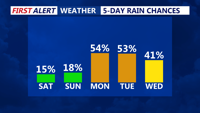

DELMARVA - For today through Saturday night, a stalled front will weaken further. With less forcing aloft and only modest afternoon heating, thunderstorms should become more isolated to scattered and mainly develop inland, away from the cooler marine influence.

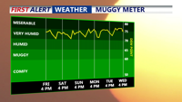
A bit more sunshine will nudge daytime highs back toward the upper 80s to near 90 degrees in the warmest locations this weekend, with heat indices possibly approaching 100. Overnight lows will stay around 70, offering little relief from the humidity.


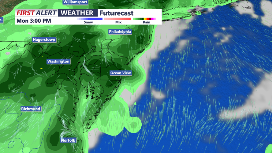
The weather pattern will shift again on Sunday as a stronger cold front approaches from the northwest. This system will bring better chances for more organized afternoon and evening thunderstorms, along with a higher risk of localized flooding and stronger wind gusts to the northwest of Delmarva. The front is expected to pass through the area on Monday, delivering the greatest potential for widespread rainfall and a modest drop in temperatures. There's also a chance for severe weather later Monday afternoon and evening. High temperatures on Monday will be in the mid to upper 80s, and still on the muggy side.

Behind the front, high pressure building southeast from Canada should briefly bring a drier stretch by Tuesday and Wednesday. Still, the summertime pattern will linger, with highs rebounding to the mid to upper 80s, and the possibility of spotty afternoon storms returning. Overnight lows are forecast to remain near 70 degrees through the middle of next week.