


DELMARVA - Late Friday evening in Sussex County, Delaware, a cold front is expected to move through with little to no rainfall for most areas, though an isolated sprinkle cannot be ruled out. Skies should trend drier overnight as cooler air begins to move in behind the front.
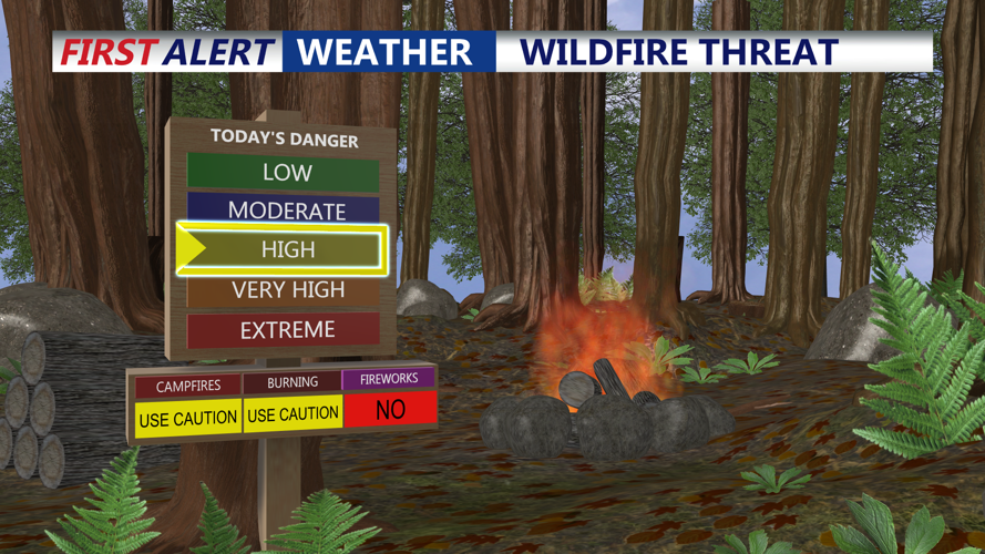
By Saturday morning and through late Saturday evening, conditions are expected to turn noticeably drier and breezy. Northwest winds will gust around 20 to 25 mph, while humidity levels fall enough to create an elevated risk for rapid fire spread. Any fire that starts could spread quickly, especially in open or grassy areas, so residents are urged to use extra caution with outdoor burning and anything that could spark a flame.
Aside from the fire danger, Saturday’s weather should remain mainly dry with seasonable temperatures and a cooler feel compared with the warmth ahead of the front. The dry pattern is expected to continue through the weekend.
Looking ahead, forecasters say a significant warming trend is likely early next week, with temperatures climbing well above normal by the middle of the week.
