


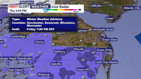


DELMARVA - A brief round of wintry weather is on track to sweep across Sussex County early Friday, bringing light accumulations inland and a quicker changeover to rain near the beaches.
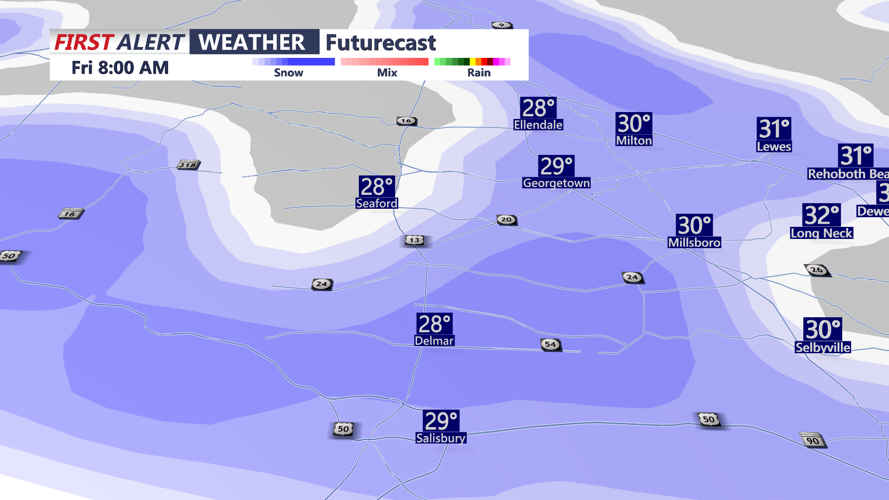
A surge of arctic air settles over the region tonight, allowing temperatures to plunge into the teens and low twenties by daybreak. That cold start sets the stage for snow to reach the county between 4 and 5 a.m. Friday, spreading from southwest to northeast as a coastal system glances the Delmarva Peninsula.
Inland Sussex: Slower Warm-Up, More Time for Snow
Communities such as Seaford, Laurel and Bridgeville will sit squarely under the coldest air when precipitation begins. Snow is expected to fall steadily through the morning, with most of the accumulation occurring before midday. Totals are expected to remain light — generally around one inch, with some spots potentially reaching 1.5 inches.
Because inland areas warm more slowly, the morning commute may feature reduced visibility and briefly slick roads, especially on secondary routes. Precipitation may mix with sleet or light freezing drizzle late in the morning or early afternoon before tapering. Temperatures drop again Friday night, raising the potential for refreezing on untreated surfaces.
Coastal Sussex: Faster Change to Rain
From Lewes and Rehoboth Beach south to Bethany Beach, Fenwick Island and Ocean City, the arrival of warmer marine air will limit snowfall. Snow may fall at the onset around sunrise, but coastal towns are expected to transition to a wintry mix and then plain rain by mid- to late morning.
Accumulations near the beaches should stay under a half-inch, and many immediate shoreline communities may see little to no sticking snow. Roads are expected to remain primarily wet except during the earliest part of the event. A few lingering rain or snow showers may persist into Friday evening before ending.
Temperatures remain below normal through the weekend, though not as harsh as Friday. Clouds linger Saturday, with another cold front set to move through late Sunday, possibly delivering a brief chance for light snow mainly north of the county. High pressure brings calmer, cold conditions Monday and Tuesday before another system approaches midweek.
