


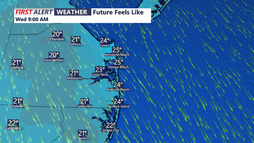


DELMARVA - Rainfall will exit Sussex County early Sunday evening as a cold front pushes offshore, opening the door to clearing skies, gusty winds and a noticeably colder air mass that will remain in place through late Monday.
As the front moves through, winds will shift sharply out of the northwest, with gusts between twenty and thirty miles per hour expected overnight. The clearing skies and incoming cold air will send temperatures into the upper twenties to near thirty degrees by early Monday morning. Drivers may encounter patchy frost, though dry conditions should limit travel impacts.
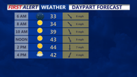
Monday will begin mostly sunny and brisk, with lingering northwest gusts gradually diminishing by midday as high pressure builds overhead. Afternoon highs will reach the mid-forties across Sussex County. Clouds will increase again late Monday evening ahead of a strengthening low-pressure system approaching from the Southeast, setting the stage for widespread precipitation to redevelop overnight into Tuesday.