


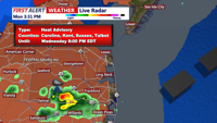
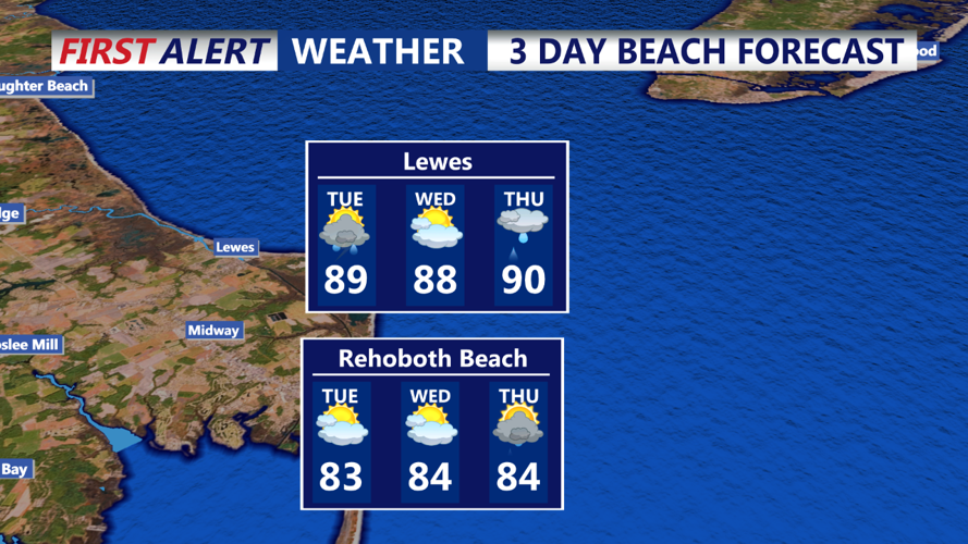


DELMARVA - The heat and humidity will persist, with increasing chances for showers and thunderstorms. The remnant low of Beryl is expected to be absorbed by an incoming upper-level trough. While this low will track well to our west and north, an approaching front will increase the likelihood of showers and thunderstorms, particularly north and west of I-95. Heat-related advisories will continue through Wednesday for most areas.
The remnant low of Beryl is forecast to be closest to our area Wednesday night into Thursday, bringing the highest concentration of showers and thunderstorms. Additional convective development is anticipated southward ahead of a cold front. Given the hot and humid conditions, the air will be buoyant, leading to increased shower and thunderstorm activity, especially north and west of I-95. Precipitable water values are forecasted to be 2.0-2.5 inches, and with high freezing levels, convection will efficiently produce rainfall. Additionally, deep-layer shear may promote convective clustering, and with some veering in the lowest levels, stronger convection is possible, mainly in the northern areas. Ample boundary layer warming before any convection should steepen low-level lapse rates, potentially backing the surface flow slightly and leading to a risk of locally strong winds, especially near and north of I-95. More convection is expected on Thursday as a cold front arrives, providing additional lift along with the incoming upper-level trough.