




DELMARVA - A stretch of hotter-than-normal weather will begin early Tuesday, with inland temperatures climbing into the lower to middle 90s during the afternoon.
The day will begin warm and mostly clear, with temperatures rising quickly after sunrise. Highs should reach the upper 80s near the beaches and the lower to middle 90s farther inland, including Georgetown, Seaford and Laurel.
Humidity will remain moderate Tuesday, keeping heat index readings below advisory levels. Even so, residents working or exercising outdoors should take breaks and drink plenty of water as the heat builds.
A west-to-southwest wind will develop as high pressure expands toward the East Coast and warmer air spreads across the Delmarva Peninsula. Offshore flow should prevent additional tidal flooding after any isolated problems around the overnight high tide.
Tuesday night will remain mostly clear, warm and increasingly humid. Temperatures will only fall into the lower to middle 70s inland, with readings remaining in the upper 70s near the coast by early Wednesday morning.
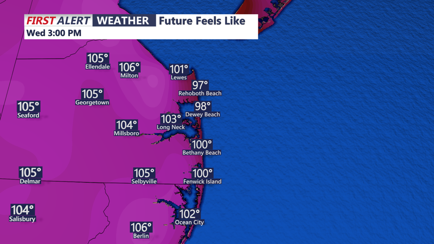
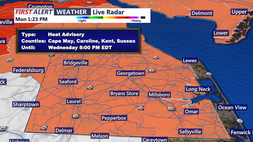
Wednesday is expected to be the hottest day of the week. A Heat Advisory covers inland Sussex County, while the Delaware beaches are excluded. Afternoon temperatures are expected to rise well into the 90s, and increasing humidity could produce heat index readings near or above 105 degrees away from the immediate coast.
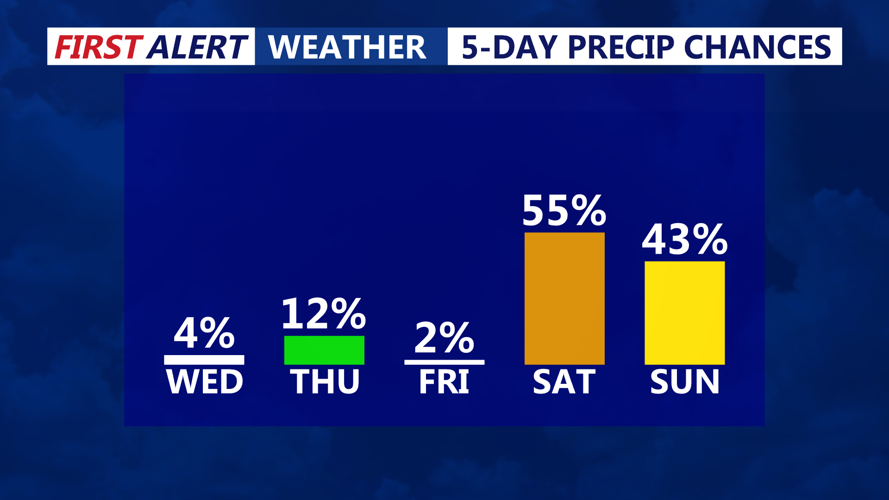
Above-normal temperatures are expected to continue through the end of the week. Shower and thunderstorm chances may return during the weekend, when some storms could produce damaging winds, heavy rainfall and localized flash flooding.
