


DELMARVA - Skies will remain mostly clear Friday night with lows dipping into the upper 60s to near 70 along the southern half of the county, providing a comfortable night thanks to lower humidity and a northwest breeze. The weather remains quiet as high pressure builds over the region.
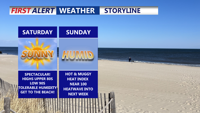
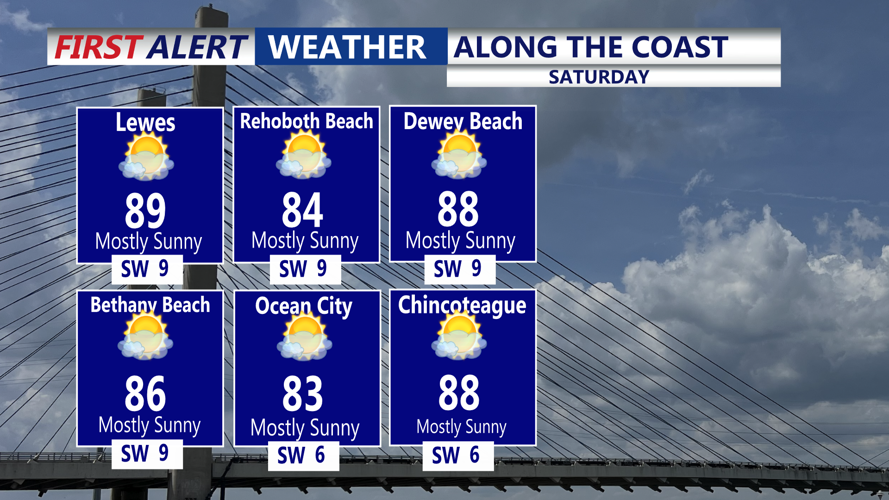
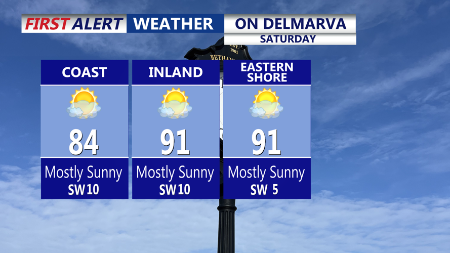
On Saturday, sunshine will dominate with daytime highs climbing into the upper 80s to around 90°F across inland Sussex County. Coastal communities may stay slightly cooler, topping out in the low to mid 80s. Humidity levels will be moderate, with dew points in the mid 60s — warm, but not oppressive.
A weak surface trough could drift across the area Saturday evening, potentially triggering a few isolated storms north of the region. However, Sussex County is expected to remain dry, aside from a few passing clouds. Overnight lows Saturday will be warmer due to a shift to southwesterly winds, falling to the low 70s near the coast and mid-to-upper 60s inland.
Sunday and Beyond:
The high pressure system shifts and expands by Sunday, ushering in a period of intense heat and rising humidity. Sunday’s highs are forecast in the low to mid 90s, with dew points climbing into the upper 60s to low 70s. Inland heat indices could range from the upper 90s to near 100°F. The National Weather Service has extended its Extreme Heat Watch to include Sunday.
Sunday night offers little relief, with lows staying in the 70s and some urban pockets possibly remaining in the upper 70s overnight.
The heat wave is expected to peak Monday and Tuesday, with daytime temperatures soaring well into the 90s and heat indices exceeding 105°F in some locations. A continued Extreme Heat Watch is in effect through Wednesday. Limited overnight cooling will raise concerns for heat-related illnesses, particularly in vulnerable populations.
Looking ahead to midweek, the ridge may gradually weaken and shift westward, which could allow for slightly reduced heat and a chance of showers or thunderstorms by late Wednesday or Thursday.
Precautions:
Residents are advised to limit outdoor activities during peak heat hours, stay hydrated, and check on elderly neighbors and pets. Cooling centers may be activated if the heat wave intensifies further.
