



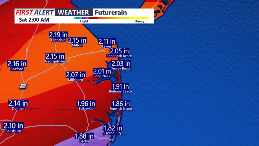
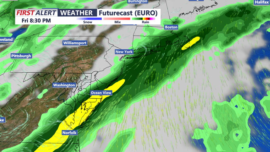

DELMARVA - A slow-moving cold front approaching Delmarva will bring increasing clouds, scattered showers and unusually mild temperatures Thursday, followed by a growing threat of heavy rainfall overnight into early Friday morning across the Delaware beaches.
Early Thursday morning will begin with mostly cloudy skies and relatively mild temperatures in the lower 60s. Most communities, including Salisbury, Georgetown, Seaford, Millsboro, Lewes and Rehoboth Beach, should experience generally quiet conditions during the early morning hours, although a few showers could begin developing as the day progresses.
Temperatures will climb quickly Thursday, with afternoon highs reaching the middle to upper 70s in many inland locations. Southerly winds will increase throughout the morning and afternoon, occasionally gusting between 20 and 25 mph, particularly along coastal communities from Prime Hook south through Fenwick Island.
Clouds will dominate much of the day, with occasional breaks of sunshine possible. Scattered showers will become increasingly likely. Communities closer to the Atlantic coast, including Ocean City, Lewes, Rehoboth Beach, Dewey Beach and Bethany Beach, could experience longer stretches of dry weather before rain chances increase later in the day.
By Thursday evening, the approaching cold front will begin interacting with increasing atmospheric moisture, allowing showers to become more widespread. Rainfall could turn locally heavy overnight, with a few embedded thunderstorms also possible.
The greatest concern will develop late Thursday night into Friday morning as the cold front slows across the region. This sluggish movement could allow repeated periods of rainfall over the same communities, increasing the potential for significant rainfall accumulations.
Current forecast guidance indicates that portions of southern Delaware and the nearby Atlantic coastline could receive 1 to 1.5 inches of rainfall during a 24-hour period. However, the location of the heaviest rain remains uncertain and will depend on exactly where the cold front slows or stalls.
Although much of the rainfall will be beneficial, heavier downpours could result in standing water along poorly drained roads, parking lots and other low-lying locations. Drivers traveling early Friday morning should be prepared for wet roadways, reduced visibility and potentially slower commuting conditions.
Rain is expected to continue at times Friday morning, with occasional heavier showers possible as the frontal boundary remains nearby. Temperatures will stay unusually mild overnight, generally in the 60s, before cooler air begins arriving later Friday and into the weekend.
Marine conditions will also deteriorate Thursday night across the coastal waters. Southerly winds could approach 25 mph, with offshore seas building to 3 to 5 feet. Small Craft Advisories may become necessary, particularly for the Atlantic waters.
The unsettled weather pattern will continue through Friday before the cold front moves offshore Saturday. Behind the front, temperatures will turn noticeably cooler, with weekend highs generally ranging from the upper 50s to middle 60s.
Additional cooling is expected Sunday into early next week, when overnight temperatures could fall into the 30s.
For residents and visitors along the Coastal Highway beach corridor, from Lewes and Rehoboth Beach south through Bethany Beach, Fenwick Island, and Ocean City Thursday's main weather story will be the transition from warm and occasionally breezy conditions to increasingly wet weather overnight.
By early Friday morning, widespread showers and locally heavy rainfall could create challenging travel conditions as the slow-moving cold front continues its passage through Delmarva.
