


DELMARVA - High pressure currently over the Mid-Atlantic is expected to settle offshore tonight, maintaining generally calm conditions across Sussex County’s beach communities. As this high shifts to the Southeast Coast, a weak warm front will lift northward through the region overnight, bringing a warmer and more humid airmass.
Temperatures will remain mild tonight, with lows ranging from the upper 40s to low 50s across the coastal areas. Winds will ease to around 5 mph from the south, providing a calm and pleasant overnight period.
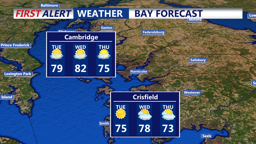
Tuesday will feature noticeably warmer temperatures, with highs climbing into the upper 70s to near 80 degrees inland. Along the beaches, temperatures will be slightly cooler due to the onshore flow. Warm air advection will be firmly underway, and southwest winds will strengthen throughout the day, reaching 15 to 20 mph with gusts up to 30 mph possible during the afternoon hours.
Although Tuesday daytime will remain mostly dry, an approaching cold front will begin to impact the area by late evening. Showers and isolated thunderstorms may begin moving into the region overnight Tuesday. However, the strongest storms are expected to weaken as they approach the coast, reducing the severe weather threat.
Looking ahead, the cold front will cross the area during the day Wednesday, ushering in slightly cooler temperatures. High pressure will return by Wednesday night, bringing drier and cooler air with lows dropping into the mid-40s to low 50s.
The longer-term forecast points to an unsettled period late in the week, with another system bringing a renewed chance for showers and thunderstorms by Friday before cooler, more stable conditions return for the weekend.
