


DELMARVA -- Fierce winds battered Delmarva on Sunday, toppling trees, damaging roofs, and prompting weather alerts as gusts soared past 60 mph.

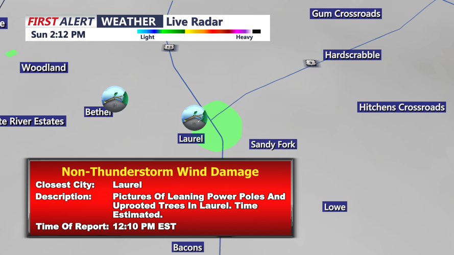
Reports of wind damage today in Laurel winds gusting to 65 MPH.
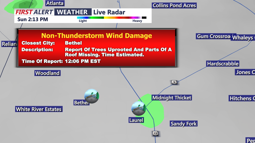
Laurel and Bethel were among the hardest-hit areas, with reports of structural damage and debris scattered by powerful non-thunderstorm winds.

Gust as high as 67 mph in Bethel on Saturday.
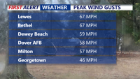
Peak wind gusts reached 67 mph in Lewes and Bethel, while Dewey Beach recorded 59 mph and Georgetown saw speeds up to 46 mph. The gusty conditions followed a day of milder temperatures, as rain moved through and temperatures briefly climbed into the low to mid-60s.

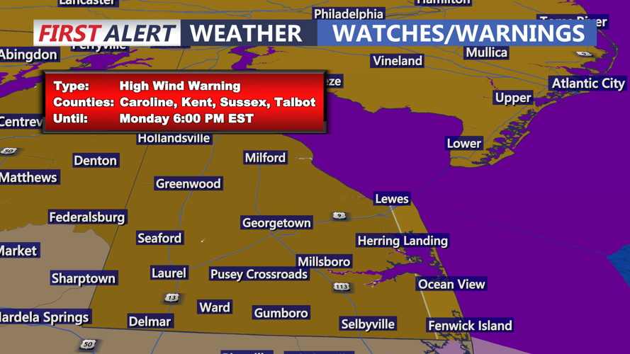
High Wind Warning continues through 6PM Monday.
However, that brief warm-up is coming to an abrupt end. A vigorous cold front sweeping through the region will send temperatures plunging into the 30s overnight, with wind chills making it feel like the teens and twenties by Presidents’ Day. Winds will remain a concern, with gusts between 40 and 55 mph continuing through the holiday. A Red Alert remains in effect for hazardous wind conditions.
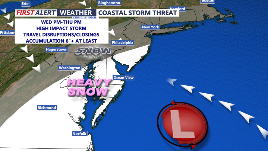
Looking ahead, a developing coastal storm could bring significant snowfall to Delmarva by midweek. Early forecasts indicate the potential for at least six inches or more of snow across much of the peninsula from Wednesday afternoon into Thursday.

A midweek threat for widespread snowfall is growing.
However, uncertainties remain regarding the storm’s exact track and intensity. The First Alert Weather Team has issued another Red Alert for Wednesday and Thursday due to expected travel disruptions.