







DELMARVA - The remnants of former Hurricane Isaias will continue to affect Sussex County and coastal communities from Lewes and Rehoboth Beach south through Bethany Beach, Fenwick Island and Ocean City, Maryland, late Sunday evening into early Monday before gradually moving away from the region.
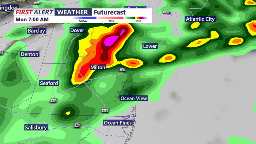
Scattered showers are expected to become more widespread Sunday evening as the weakening storm system moves northeast across the Mid-Atlantic. A few thunderstorms could develop overnight, particularly across southern Delaware and Maryland's Eastern Shore. Although the overall severe weather threat remains low, an isolated stronger storm could produce gusty winds and locally heavy downpours.
Total rainfall from the storm is expected to average 1 to 2 inches across much of the region. Additional rainfall overnight could cause ponding on roads and minor flooding in low-lying and poorly drained areas. An isolated instance of flash flooding remains possible.
Temperatures Sunday night will remain relatively mild, with overnight lows generally in the lower to middle 60s. East to northeast winds will remain noticeable before gradually shifting toward the north and northwest as the storm moves away.
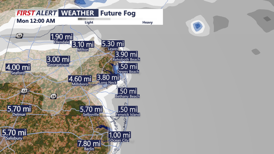
By early Monday morning, the steadiest rainfall should be ending, although lingering showers, low clouds and areas of fog could create reduced visibility for commuters. Motorists traveling along Route 1, Route 113 and coastal roadways should remain alert for wet pavement and patchy fog.
Conditions will gradually improve through late Monday morning and into the afternoon as drier air begins moving into the region. Clouds should slowly break for periods of sunshine, especially later in the day.
Afternoon temperatures are expected to reach the upper 60s to near 70 degrees across Sussex County, including Georgetown, Millsboro and Seaford. Similar temperatures are anticipated in coastal communities from Lewes and Rehoboth Beach to Bethany Beach, Fenwick Island and Ocean City.
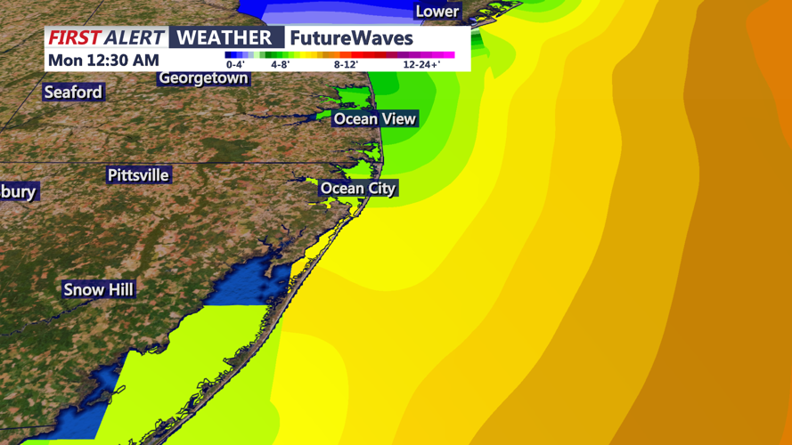
Along the beaches, rough surf and hazardous marine conditions will remain concerns even after the heaviest rainfall ends. Small Craft Advisories remain in effect for coastal waters into Monday night, with elevated seas and gusty winds making conditions dangerous for smaller vessels.
Minor tidal flooding also remains possible around Monday morning's high tide, particularly in vulnerable areas along the Delaware Bay, Atlantic coastline and coastal back bays. No coastal flood advisories were in effect for Sussex County in the latest Sunday afternoon forecast discussion.
By late Monday evening, improving weather conditions are expected as the remnants of Isaias depart and high pressure begins building into the region. Skies should become partly cloudy to mostly clear, with diminishing winds and temperatures gradually falling through the 60s.
The improving weather will continue into Tuesday, when warmer temperatures and more sunshine are expected across much of the Delaware coast.
