




DELMARVA - A developing coastal storm will bring a chance for showers to Sussex County early Thursday morning through early Friday morning, with periods of rain, increasing winds and the arrival of colder air across southern Delaware.
Thursday morning will begin with mostly cloudy skies as low pressure strengthens across the northern Mid-Atlantic. Scattered showers are expected to develop during the morning, spreading across inland communities including Georgetown, Seaford, Laurel and Millsboro before reaching coastal areas from Lewes and Rehoboth Beach south through Bethany Beach and Fenwick Island.
Rainfall amounts are expected to remain relatively light across Sussex County, with most locations receiving less than a quarter of an inch through the storm. The developing system is expected to track farther north, keeping the heaviest precipitation across Pennsylvania and New Jersey.
The Storm Prediction Center has placed a part of the peninsula in a Marginal risk for severe storms, from Delaware on northward. While the risk is low, the chance of a brief gusty thunderstorm cannot be ruled out this afternoon. Damaging wind gusts in excess of 60 mph and hail are the primary threats.
Temperatures Thursday afternoon should reach the lower 60s at the coast to mid to upper 60s inland, providing relatively mild conditions despite extensive cloud cover and occasional showers.
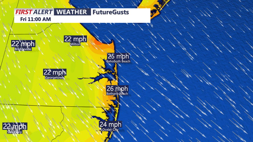
East to southeast winds will increase to around 10 to 20 mph during the morning, with occasional gusts approaching 25 mph, particularly near the Delaware beaches. Winds will gradually shift toward the south and southwest during the afternoon as the developing low-pressure system organizes near the New Jersey coastline.
Rain could become more scattered during the afternoon, with occasional breaks in the clouds possible. However, additional showers may develop Thursday evening as the storm continues intensifying and moving northeastward.
Coastal communities, including Prime Hook, Lewes, Rehoboth Beach, Dewey Beach, Bethany Beach and Fenwick Island, should remain alert for elevated tides and the possibility of minor tidal flooding in vulnerable low-lying areas. The extent of any coastal flooding will depend on the storm's exact track and how long onshore winds persist.
By Thursday night, the storm will begin drawing colder air southeastward across Delmarva as winds gradually shift toward the northwest.
Temperatures will fall through the 40s Thursday night, with readings approaching the upper 30s to lower 40s across Sussex County by early Friday morning. Northwest winds will become increasingly noticeable, making conditions feel colder as the morning approaches.
Periods of rain could continue overnight, although precipitation coverage and intensity remain uncertain. The greatest rainfall amounts are expected well north of Sussex County, and snow is not anticipated across southern Delaware.
Marine conditions will also deteriorate Thursday night as the storm strengthens offshore. Small Craft Advisory conditions are expected to become increasingly likely across Delaware's Atlantic coastal waters and Delaware Bay.
The strongest winds are expected to develop Friday afternoon into Friday night, when some gusts over the coastal waters could reach gale force. Boaters and commercial fishing operators should prepare for hazardous conditions extending into the weekend.
Friday will mark the beginning of a prolonged stretch of below-normal temperatures as much colder air moves across the region.
Afternoon highs Friday and Saturday are expected to remain in the 40s across much of Sussex County, while overnight temperatures could fall into the 20s and lower 30s.
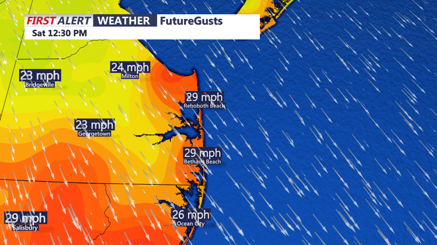
Saturday is expected to be particularly blustery, with northwest wind gusts approaching 35 mph. The combination of colder air and persistent winds will make outdoor conditions feel considerably colder than the actual temperatures.
The colder weather could also bring the season's first widespread freeze to portions of Sussex County, especially across inland communities where temperatures are most likely to drop below 32 degrees.
Some improvement is expected Sunday into early next week as temperatures gradually moderate. However, afternoon highs will likely remain in the upper 40s to lower 50s, keeping conditions below seasonal averages.
For residents along Delaware's beaches and across inland Sussex County, Thursday's light rain and increasing winds will signal the beginning of a significant weather transition, with the coldest and windiest conditions still ahead for the weekend.
