


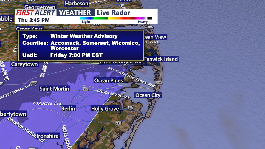

DELMARVA - A fast-moving coastal system will bring a brief round of wintry weather to Sussex County from early Friday morning through early Saturday, producing light snow inland, a wintry mix along the beaches and a sharp drop in temperatures Friday night.
Early Friday Morning: Snow Expands Inland First
Snow is expected to reach southwestern Sussex County — including Seaford, Laurel and Delmar — between 4 and 5 a.m. Friday, spreading northeast toward Milford and Georgetown shortly after sunrise. With cold air firmly in place, inland areas will see steady light snow through midmorning, allowing for accumulations around one inch, with a few spots approaching 1.5 inches.
Roads may become slick for the morning commute, particularly on untreated and rural routes. Visibility could briefly drop during periods of steadier snow.
Coastal Sussex: Quick Transition to Rain
Along the beaches — Lewes, Rehoboth Beach, Bethany Beach, Fenwick Island and Ocean City — snow arrives around sunrise but will change to a mix and then rain by late morning as slightly warmer ocean air moves inland. Accumulations at the immediate coast should stay below a half-inch, and many shoreline areas may see little sticking snow.
Travel impacts are expected to be minimal along Coastal Highway and barrier-island routes, though brief early-morning slick spots remain possible.
Friday Afternoon and Evening: Drizzle, Flurries and Falling Temperatures
As the system pulls away, lingering light rain and snow showers may continue into the afternoon and evening. A shallow warm layer aloft combined with surface temperatures falling into the 20s could allow patchy freezing drizzle in inland areas late Friday evening. While moisture will be limited, any light glaze could create slippery spots.
Winds remain lighter than Thursday, but the reinforcing cold air will be noticeable. Temperatures drop steadily through the night.
Early Saturday Morning: Hard Freeze Sets In
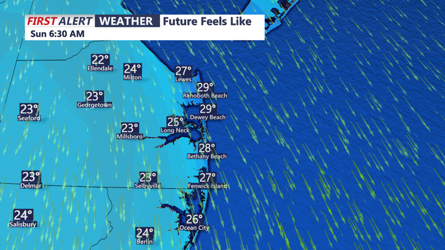
By daybreak Saturday, Sussex County will be under a hard freeze, with lows in the low to mid-20s countywide and teens in the coldest inland pockets. Any leftover moisture on roads, sidewalks or bridges may refreeze, particularly north and west of Route 113.
Clouds gradually break Saturday morning as high pressure returns, but temperatures will stay below normal to start the weekend.
