




DELMARVA - Residents can expect another unusually warm November day Wednesday, with temperatures climbing into the 70s before a slow-moving cold front brings increasing chances for rain late Thursday and potentially heavy rainfall Friday.
Patchy fog could develop early Wednesday morning as light winds and lingering moisture create favorable conditions for reduced visibility. While widespread dense fog is not anticipated, motorists traveling through inland communities such as Georgetown, Millsboro, Seaford, Laurel, and Salisbury should remain alert for locally reduced visibility during the morning commute.
Any fog that develops should dissipate by approximately 9 or 10 a.m., giving way to a pleasant afternoon with a mixture of sunshine and a few clouds. Temperatures will climb into the 70s, continuing an extended stretch of above-normal warmth for early November.
Along the Delaware beaches, including Lewes, Rehoboth Beach, Dewey Beach, Bethany Beach, Fenwick Island, Ocean City, mild conditions will prevail Wednesday with southerly to southwesterly breezes. No significant weather hazards are anticipated throughout the day.
Wednesday evening will remain generally quiet as high pressure offshore continues to influence the region. Clouds may gradually increase overnight into early Thursday morning as a cold front approaches from the west.
Temperatures will remain relatively mild overnight, with no significant precipitation expected through early Thursday.
The weather pattern begins changing later Thursday as the approaching cold front slows near the Mid-Atlantic coast. Although a few showers could develop Thursday should remain mainly dry during the daytime hours.
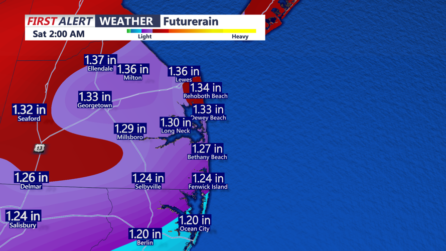
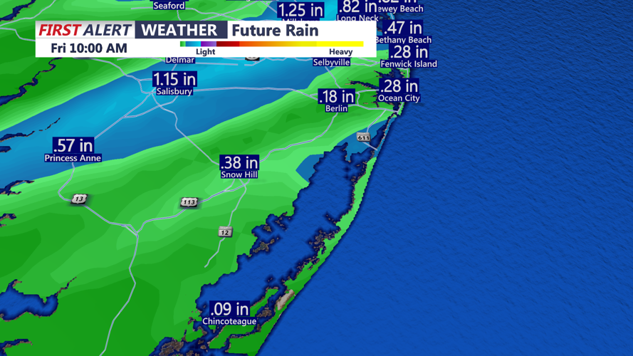
Rain chances will increase Thursday night into Friday as the front potentially stalls near the region and an area of low pressure develops along the boundary. A surge of Atlantic moisture could support periods of moderate to heavy rain, particularly south and east of the Interstate 95 corridor.
That places the coastal communities within an area that could experience heavier rainfall Friday.
The exact location of the heaviest rain remains uncertain and will depend on where the front stalls and how quickly the developing low-pressure system moves northeast. A slower-moving system could produce prolonged rainfall and isolated flooding concerns, especially in low-lying and poorly drained locations.
Looking ahead, rain chances should gradually decrease heading into the weekend, although lingering disturbances could bring occasional showers into early next week.
Boaters can expect relatively favorable marine conditions Wednesday, with southerly winds near 10 to 12 mph and seas around 1 to 2 feet. Seas may build to 3 to 5 feet Thursday night into the weekend, potentially creating conditions hazardous to smaller vessels.
The immediate forecast remains favorable through early Thursday, with Wednesday offering another opportunity to enjoy mild autumn temperatures before a wetter weather pattern arrives late in the week.
