


DELMARVA - A few showers early Friday as a cold front continues to move south of the region, but conditions are expected to improve through the day and remain quieter into early Saturday.
A stray shower, and possibly an isolated thunderstorm, may develop Friday morning across parts of Delmarva. The chance for wet weather should fade by the afternoon as the front pushes farther south and drier air builds into the area.
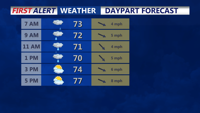
Friday will feel more seasonable after Thursday’s surge of heat, wind and humidity. Highs are expected to reach the lower 80s, with lower humidity making conditions more comfortable through the afternoon and evening.
At the beaches, the risk of rip currents is expected to drop from high on Thursday to low on Friday for Delaware beaches. Winds should turn west-southwest at 5 to 15 mph, with breaking waves of 1 to 3 feet.
Coastal flooding concerns are also expected to ease. Forecasters said astronomical tides should be low enough to prevent additional flooding impacts after Thursday night, while offshore winds help drain the bays through early Saturday.
By late Friday night and early Saturday morning, Sussex County should remain mainly dry, calmer and more comfortable.
