


DELMARVA -- We continue to be in the grip of dangerous cold, and we could be close to record territory by this afternoon. High temperatures will struggle to climb out of the low to mid 20s, and that’s cold enough to challenge the record cold high at Georgetown, where the standing mark is 24 degrees set back in 2010. A steady northwest wind will add an extra bite, gusting to around 20 mph and knocking wind chills down to roughly 6 to 12 degrees through the day. A few high clouds will increase late this afternoon into the evening, but overall conditions stay dry and sharply cold.
Tonight brings yet another frigid, frosty night across the peninsula. Temperatures will tumble into the single digits, ranging from about 4 to 12 degrees by daybreak Saturday. With the breeze continuing, wind chills could fall as low as 3 to 6 below zero early Saturday morning, especially in more exposed locations. Cold Weather Advisories remain posted for all of Delaware and the northern Mid-Shore into Sunday morning, underscoring the risk for frostbite and hypothermia if you’re outside for extended periods.
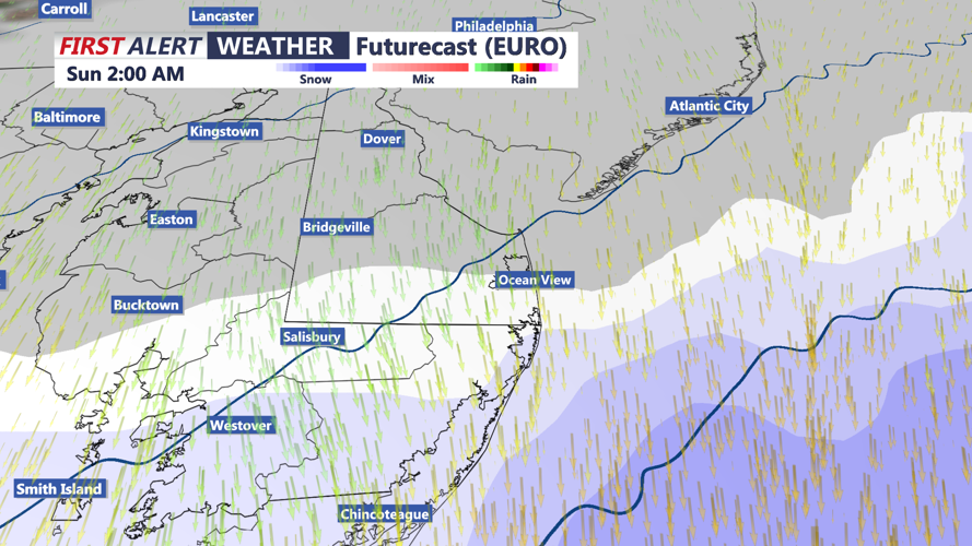
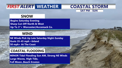
Saturday stays bone-chilling from start to finish, with highs again only in the low to mid 20s. Clouds will steadily increase ahead of a developing coastal storm, and light snow is expected to develop Saturday evening.
Looking toward the weekend storm, a rapidly deepening low is expected to develop off the East Coast. While the storm should track far enough east to spare most of Delmarva from the most significant impacts, it is still close enough to bring hazards, especially near the coast.

Light snow develops late Saturday night, sharp cutoff to the north and west.
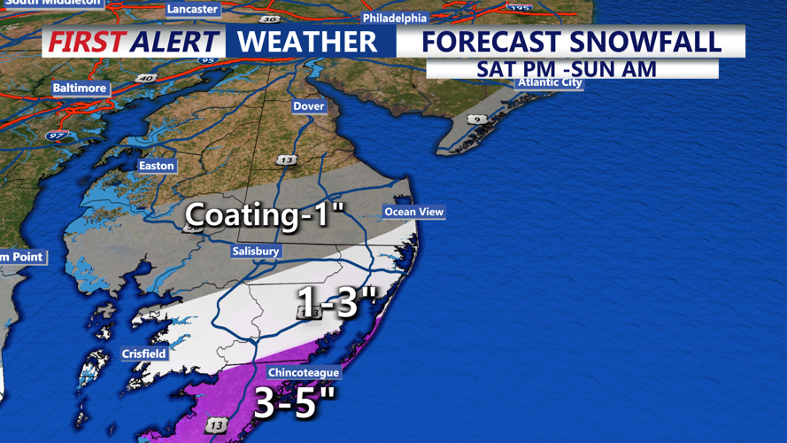
The latest trend suggests the best chance for accumulating snow is increasingly focused farther south, with meaningful accumulation generally confined to southern Sussex County and down toward the southern half of the peninsula as the precipitation shield shifts a bit east. Coating to an 1 inch for Sussex County, down to Salisbury and Cambridge. A narrow line of 1 to 3 inches Ocean City to Berlin to Crisfield. Highest totals from southern Worcester and Accomack Counties where 3 inches or more is possible. In fact Accomack county could see near blizzard conditions late Saturday night.

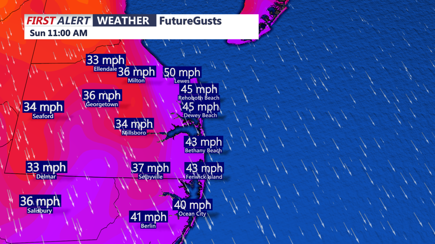
Coastal flooding, pockets of light snow, and high winds remain possible, and peak wind gusts near or above 50 mph are now on the table for coastal areas.

As the coastal low deepens offshore winds will gust to near 50 mph at the coast, coastal flooding is a concern, MINOR tidal flooding possible.
Even if inland locations avoid the worst, the coastline could see strong wind impacts and periods of rough conditions. Blistering wind chills Sunday and the threat of MINOR coastal flooding through high tide cycles Sunday and Monday. Higher then normal wave action 10'+, full moon, strong northeast winds.

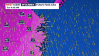
Wind chills Sunday will be -1 to near -9 below zero.
Beyond the weekend, we’re watching another potential system for the middle of next week as a low pressure area passes south of the region. Some model guidance depicts development tied to a lee-side trough over eastern New Mexico and the Texas Panhandle that then progresses east across the Southeast and eventually offshore. As we’ve seen with recent systems, the exact track will matter a lot for Delmarva. A farther south track would reduce snow chances locally but could reinforce very cold air later next week, particularly Thursday and Friday. For now, a blended, middle-ground forecast points to a broad 20 to 40 percent chance for precipitation midweek, with temperatures running about 5 to 10 degrees below normal as the cold pattern continues.
Stay up to date on the approaching winter storm with radar and hourly forecasts in the CoastTV weather app, available for Apple and Android.

