


DELMARVA - Residents along Delaware’s coast will wake up to damp, breezy conditions Monday morning as a powerful coastal storm that lashed the region through the weekend slowly pushes away. While the worst impacts of wind and flooding will ease, unsettled weather will persist into early Tuesday before a quieter pattern takes hold midweek.

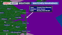
Coastal Flood Warning remains in effect until 8:00 PM.
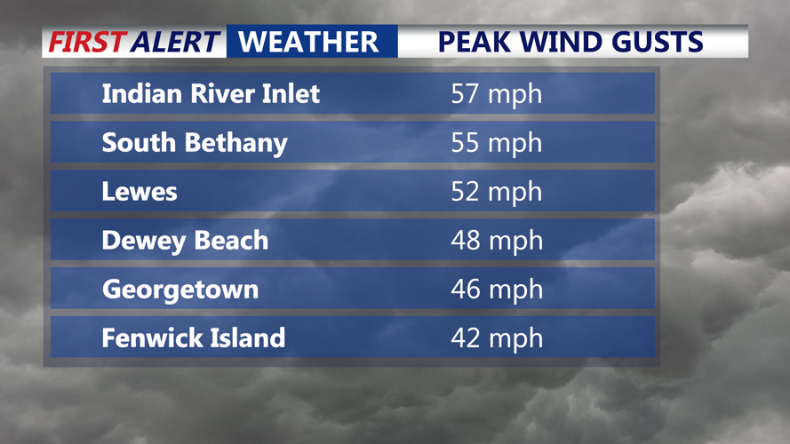
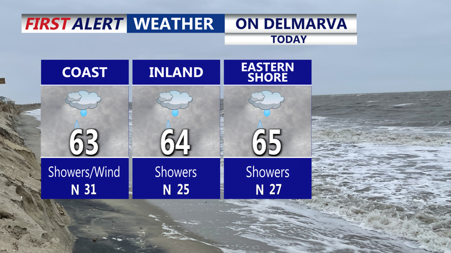
By sunrise Monday, winds will have weakened from Sunday night’s damaging gusts but remain strong enough to pose challenges near the shoreline. Gusts of up to 30 mph inland and 40 mph along the coast are expected through much of the day, keeping seas rough and driving additional water onto beaches and bayside communities during high tide cycles. Minor to moderate coastal flooding remains possible, along with areas of beach erosion and standing water on low-lying roads.

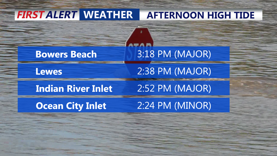
Next high tide will be Monday afternoon, expecting another round of MAJOR coastal flooding along the Delaware coastline.
Rainfall will gradually taper from east to west throughout the day. Most areas will see periods of light rain or drizzle into the afternoon, with total rainfall amounts reaching around 2 inches along the coast and up to 1 inch farther inland.

Low clouds, on and off showers/drizzle, breezy gusts to 35-40 MPH.
Temperatures will stay cool, holding in the upper 50s to low 60s under overcast skies. Overnight lows will settle into the low to mid-50s with lingering dampness.
Tuesday morning will begin with clouds and a slight chance of showers as the coastal system continues to move offshore. By midday, drier air will filter in, allowing skies to brighten and conditions to improve significantly. Sunshine is expected to return by afternoon with highs reaching the mid to upper 60s, near seasonal norms for mid-October. Winds will diminish throughout the day, shifting northerly at 10 to 15 mph.
By early Wednesday morning, high pressure will be firmly in control, bringing clear skies and calm weather to Sussex County. Overnight lows will dip into the low 50s, and the region will enter a stretch of dry, seasonable weather through midweek.
Be sure to download our weather app:


