


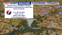


DELMARVA -- The National Weather Service has confirmed that an EF-1 tornado touched down Friday evening, carving a destructive path through parts of Dorchester County, Maryland, and Sussex County, Delaware. The tornado packed peak winds between 100 and 110 miles per hour and tracked 11.4 miles from near Rhodesdale, Md., through Galestown, Md., and into Delaware just south of Bethel.
The storm uprooted trees, snapped large branches, and caused damage to homes along its path. No injuries or fatalities have been reported.
On Sunday, calmer weather returned to the region with mostly sunny skies and breezy west winds. Wind gusts topped out at 41 mph in Salisbury, 35 mph in Ocean City, and 31 mph in Georgetown. A cold front is expected to reinforce the cool, dry air Sunday night, keeping temperatures in the upper 50s to low 60s overnight.

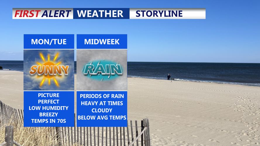
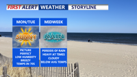
Beautiful Monday and Tuesday before unsettled weather moves into the area midweek.

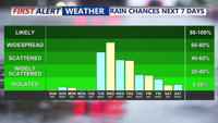
Widespread rainfall moves into Delmarva Wednesday through Tuesday.
High pressure will build in from the north on Monday and Tuesday, bringing continued sunshine and seasonable highs in the low to mid 70s. Winds will remain gusty on Monday, with speeds reaching up to 30 mph before easing Tuesday.

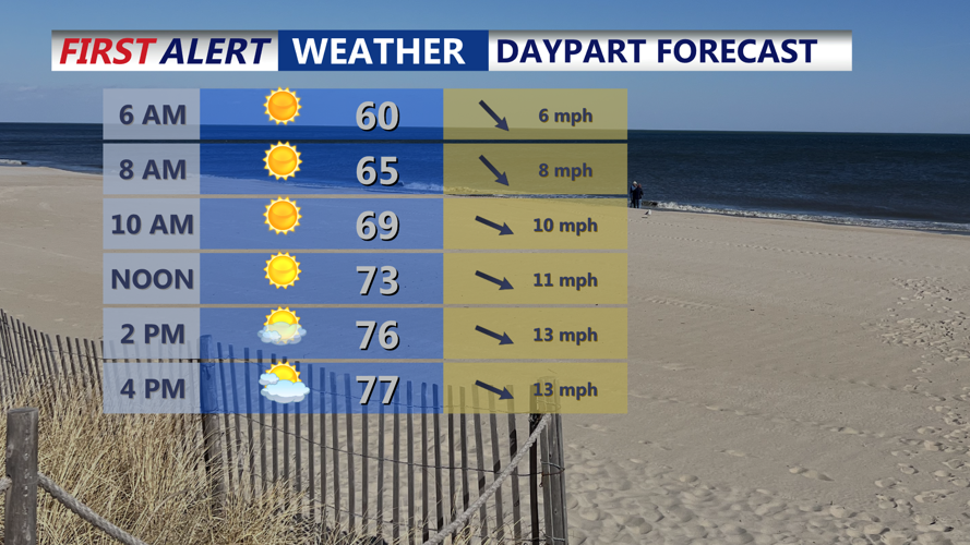
Marvelous Monday! Mostly sunny, still breezy with highs in the upper 70s.
Widespread rainfall moves into Delmarva Wednesday through Tuesday.
However, the quiet stretch will be brief. A low-pressure system approaching from the southwest is set to bring widespread rain to the region starting early Wednesday. Heavier rainfall is possible during the day, and temperatures will drop into the 50s and low 60s.

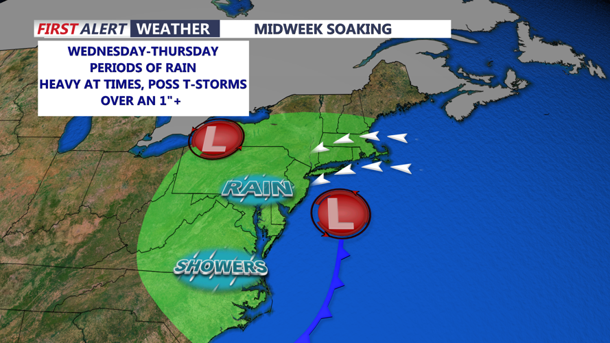
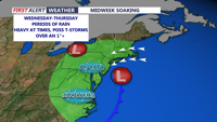
An area of low pressure will bring widespread rain to the region Wednesday-Thursday.
The rain may persist into Thursday, followed by lingering showers on Friday and Saturday as an upper-level disturbance stalls near the Northeast.
Temperatures will stay below normal through the end of the week, but a warming trend may begin by Sunday into Memorial Day.
