



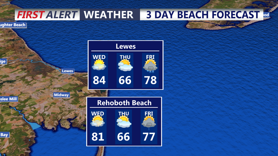
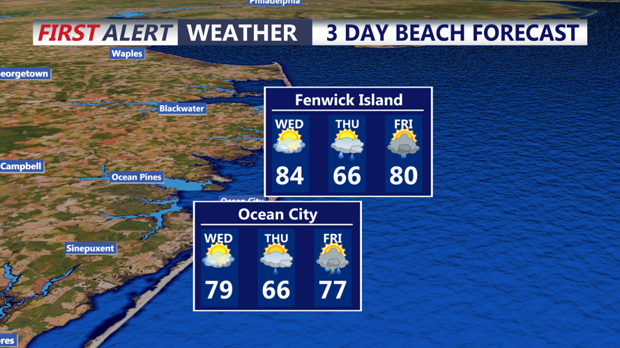

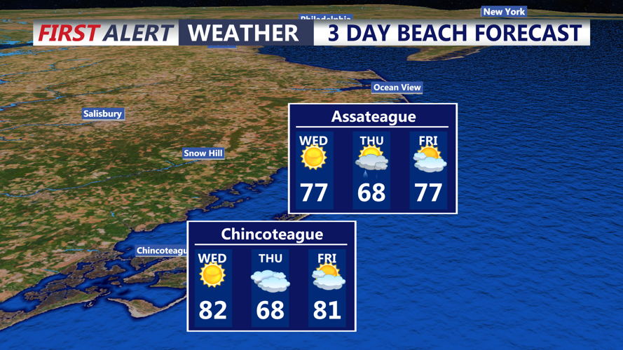


DELMARVA - A surge of unusually warm and humid air will bring summerlike conditions to southern Delaware and coastal communities extending from Lewes and Rehoboth Beach to Bethany Beach, Fenwick Island and Ocean City, Maryland, through Wednesday evening. A series of cold fronts will eventually bring a dramatic change, with much colder temperatures arriving for the weekend.
Tuesday night will remain mostly clear and unusually mild for mid-October. Overnight temperatures are expected to settle into the 60s across much of Sussex County and along the beaches. Southwest winds will continue to transport warmer, increasingly humid air into the region ahead of an approaching cold front.
Wednesday will feature a noticeable increase in warmth and humidity, with afternoon temperatures climbing into the low to mid-80s across much of the area. Inland communities, including Georgetown, Millsboro and Seaford, could experience highs in the upper 80s, with a few locations approaching 90 degrees. Coastal communities along Route 1 and south into Ocean City should experience slightly cooler conditions, although temperatures will remain well above seasonal averages.
Dew points rising into the 60s will make conditions feel more like late summer than mid-October. Heat index values could approach 90 degrees in inland areas during the afternoon.
Cloud cover will gradually increase Wednesday as a cold front approaches from the west. Although an isolated shower cannot be ruled out, rain chances remain below 25%, meaning most communities should remain dry.
West winds will increase to around 12 to 17 mph during the afternoon, with occasionally stronger gusts possible. Along the Atlantic coastline, ocean conditions should remain relatively manageable, with seas running 2 to 4 feet. No marine advisories are currently indicated through Wednesday.
The initial cold front will move through the region later Wednesday, bringing a temporary reduction in temperatures Thursday. However, the more significant weather change will arrive Friday as a powerful cold front sweeps across the Delmarva Peninsula.
Showers could begin developing Thursday night, becoming more widespread Friday. A few thunderstorms are also possible, depending on atmospheric instability and the timing of the front. Gusty winds may accompany the system.
Behind Friday's front, temperatures will tumble dramatically as a much colder air mass spreads across southern Delaware and the Maryland beaches.
High temperatures Saturday and Sunday may struggle to climb out of the 50s, representing a drop of nearly 30 degrees from Wednesday's warmest readings. Gusty northwest winds Saturday will make conditions feel even colder, particularly along the beaches and other exposed coastal locations.
Saturday night could bring some of the coldest temperatures of the season so far. If winds diminish sufficiently, frost or even freezing temperatures could become a concern, especially in sheltered inland locations. Coastal communities may remain somewhat milder because of the nearby Atlantic Ocean.
Temperatures are expected to gradually moderate early next week as the cold air mass begins to retreat.
Residents and visitors across Sussex County and Ocean City should prepare for a remarkable transition from summerlike warmth Wednesday to distinctly chilly autumn conditions by the weekend.
