


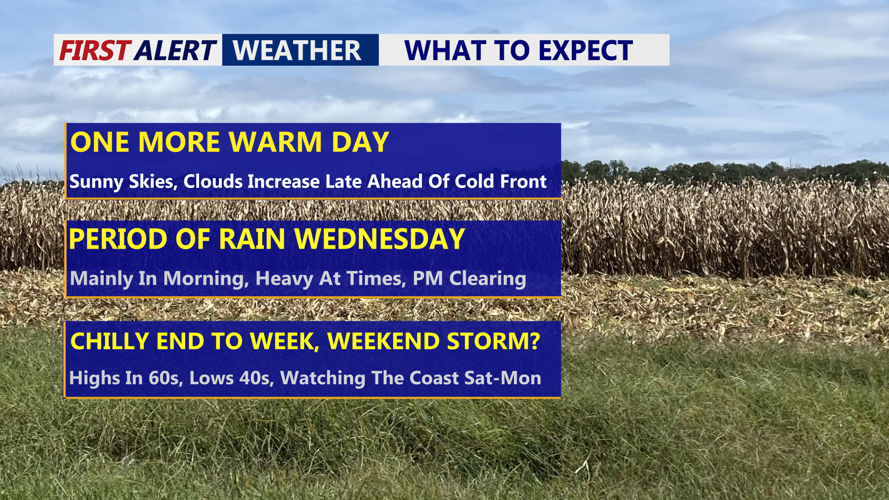

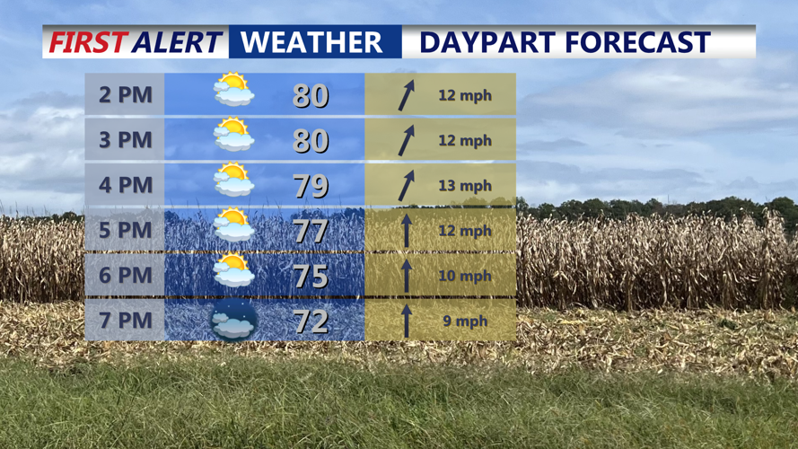


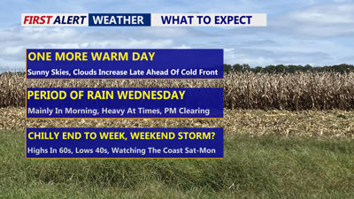
DELMARVA -- Mild and mostly dry conditions will hold over Delmarva today, but change is on the way as a strong cold front approaches from the west. High pressure offshore will dominate through much of Tuesday, allowing for one more warm day across the region. Despite thickening clouds during the afternoon, temperatures will climb into the upper 70s to low 80s as southerly winds increase ahead of the front.

Mostly sunny skies will give way to increasing clouds tonight.
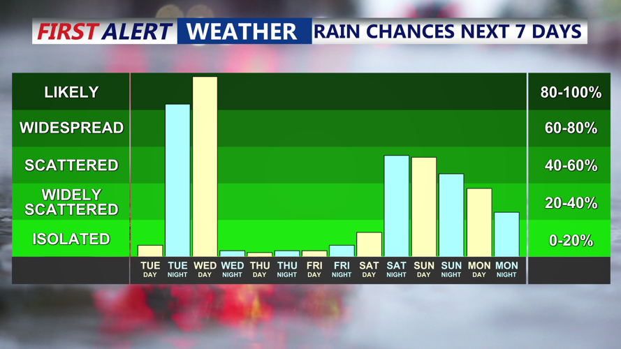
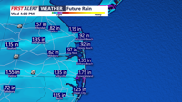
By tonight, a surge of southwesterly flow will bring widespread showers to the area. Rain will develop first over western portions of Delmarva and spread eastward toward the coast after midnight.

Rain chances ramp up Wednesday, then watching a potential coastal low impacting the region over the weekend.
Some rumbles of thunder are possible overnight, though no severe weather is expected. Rain could be briefly heavy at times, with totals averaging between half an inch and one inch.

Periods of rain Wednesday morning, heavy at times, an embedded thunderstorm possible.
The steadiest rain is expected between about 2 a.m. and 11 a.m. Wednesday before tapering from west to east as the cold front moves through.

On average around an inch of rain, Wednesday morning-afternoon.
Behind the front, skies will clear rapidly Wednesday afternoon as cooler and drier air arrives. Northwest winds may gust up to 30 mph, with temperatures falling into the mid-60s to low 70s during the day.

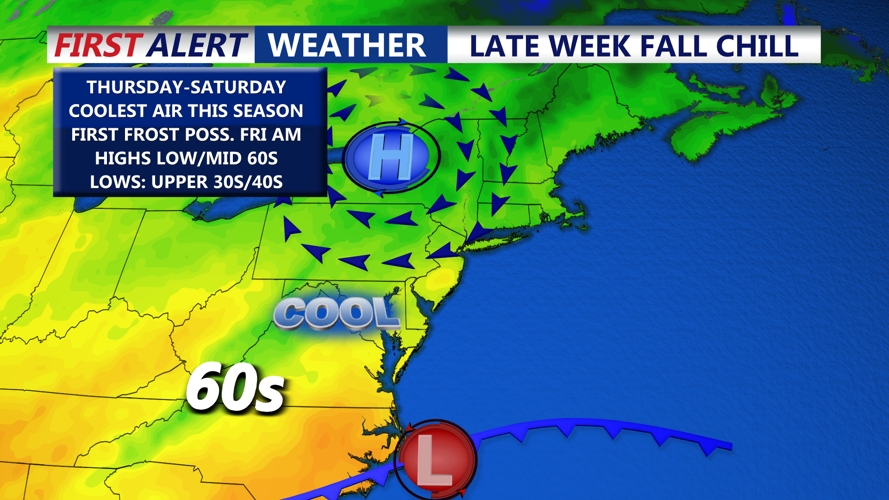
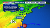
Some of the coolest air we have seen so far this fall rolls in late week, possible patchy frost Friday morning.
Cooler, crisp weather will dominate the remainder of the week. High pressure from the Great Lakes will settle over the region Wednesday night through Friday, bringing sunny but cooler conditions. Lows will dip into the 40s by Thursday morning, with highs only reaching the low to mid-60s. Patchy frost is possible Thursday night, particularly in inland areas of western Sussex and Kent counties and the Mid-Shore region if winds remain calm.
By Friday, sunshine will return with highs in the mid-60s as high pressure shifts offshore. Looking ahead to the weekend, we are watching a developing coastal system near the Carolinas that could bring clouds, wind, and possible coastal impacts to Delmarva by Sunday or early next week. While details remain uncertain, residents should stay tuned for updates on potential rain, beach erosion, or coastal flooding concerns.
