






DELMARVA - Quiet weather will continue across Sussex County late tonight and through much of Wednesday as high pressure gradually moves offshore.
Conditions should remain mainly dry overnight, with clouds gradually increasing heading into Wednesday. Wednesday will feature a mix of clouds and some sunshine, with no widespread rain expected through the evening.
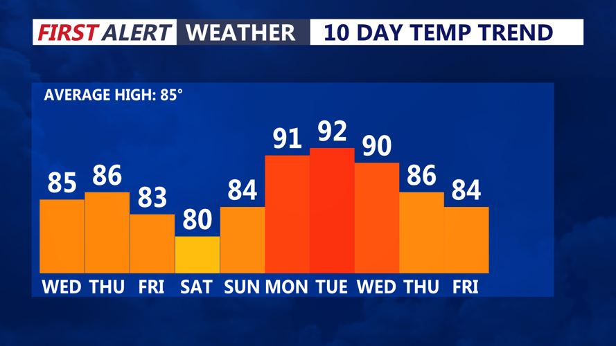
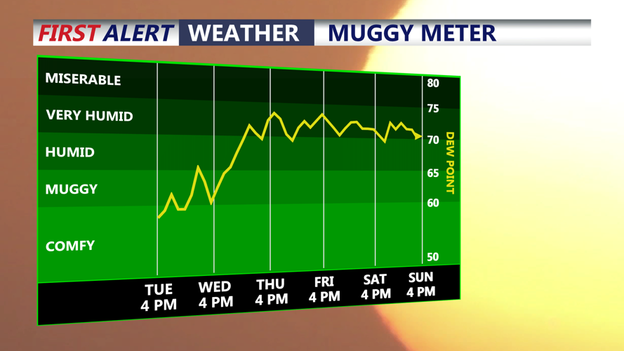
Changes begin Wednesday night as winds turn more southerly ahead of an approaching warm front. Moisture will steadily increase, with dew points climbing into the lower 70s by Thursday.
Showers are expected to become more widespread Thursday as the warm front moves through the region. Atmospheric moisture will increase to well above normal levels, creating the potential for periods of locally heavy rain. Sussex County is included in a marginal risk for excessive rainfall, although the greatest threat for heavier rain currently appears to favor areas farther north and west.
The risk of widespread flooding remains limited at this time, and the threat for severe thunderstorms Thursday also appears relatively low because instability and wind shear are expected to remain limited.
A cold front will then approach Friday, bringing another chance for showers and thunderstorms. The exact timing of that front remains uncertain and will play an important role in determining any thunderstorm threat.
Drier weather is expected to return for much of the weekend, although a few showers could linger across southern portions of the region Saturday.
