




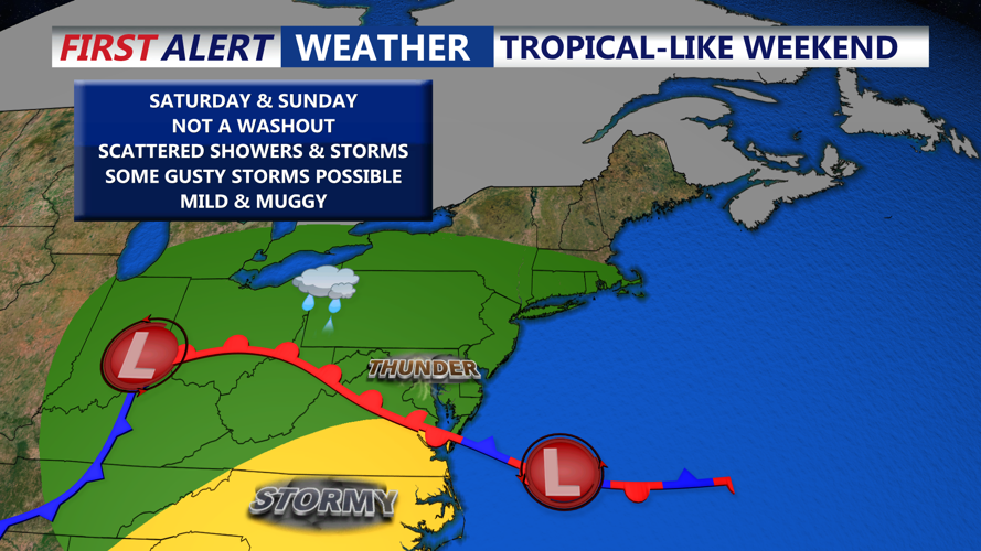

DELMARVA - Sussex County faces another stretch of unsettled weather beginning early Saturday and continuing through the early hours of Sunday, as a cold front stalls over the region and a warm front begins to take shape to the south.
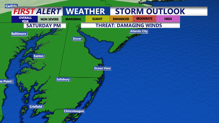
Saturday will begin damp and humid, with scattered showers and thunderstorms expected throughout the day. Intermittent downpours are possible, especially in the afternoon and evening hours, as unstable air remains in place. The Storm Prediction Center has maintained a Marginal Risk for severe weather over the region, with the potential for isolated damaging wind gusts and brief hail in stronger cells.
Visibility may be reduced at times due to fog, particularly in the early morning hours and near heavier showers. While the threat for flash flooding is lower than Friday night, any slow-moving storm could produce localized flooding in low-lying or poorly drained areas.
Temperatures on Saturday will remain seasonably warm, with highs in the upper 70s to near 80 degrees. Winds will shift to the southwest, increasing slightly by the afternoon with gusts near 15 mph.
As the cold front slowly exits the region Saturday night, shower activity is expected to taper off from northwest to southeast. However, some lingering showers and patchy fog may persist into the pre-dawn hours of Sunday, especially along coastal areas and southern Sussex County.
By early Sunday, weak high pressure building in from the north will begin to clear skies across inland areas, setting the stage for a brief dry window during the day. However, another warm front will lift toward the region by Sunday night, bringing renewed chances for storms by late evening.
