


DELMARVA - A weak ridge of high pressure will persist over the Delmarva Peninsula through Tuesday afternoon, allowing for a mild day with temperatures reaching the 50s and low 60s in southern Delaware. However, significant changes are expected as a developing storm system approaches the region tonight.
Tuesday Late Evening into Early Wednesday Morning
Rain will begin moving into the area late Tuesday evening as a warm front lifts northward. Showers will intensify overnight, becoming widespread by early Wednesday morning. Temperatures will remain mild, with lows in the mid-40s to low 50s.
Wednesday Morning and Afternoon
The storm system will strengthen as it moves over the Appalachians and into the Mid-Atlantic. Rainfall will intensify during the day, with totals ranging from 2 to 3 inches by Wednesday evening. The heaviest rain is expected in the afternoon and early evening, creating the potential for urban and poor drainage flooding. While significant flooding is not anticipated due to dry antecedent conditions, ponding on roadways and in low-lying areas may occur.
Strong winds will also develop, with sustained winds of 20-30 mph and gusts of 35-45 mph, particularly near the coast. The National Weather Service has not issued a Wind Advisory but is closely monitoring conditions.
A marginal risk (1/5) for severe weather has been issued by the Storm Prediction Center. Isolated thunderstorms may develop, with a small chance of stronger wind gusts reaching the surface.
Wednesday Evening and Night
Rain will taper off west to east during the evening as the storm system moves offshore. However, a strong cold front trailing the system will usher in gusty west winds of 30-40 mph and rapidly falling temperatures. Overnight lows will drop into the upper 20s to low 30s, with wind chills in the 20s.
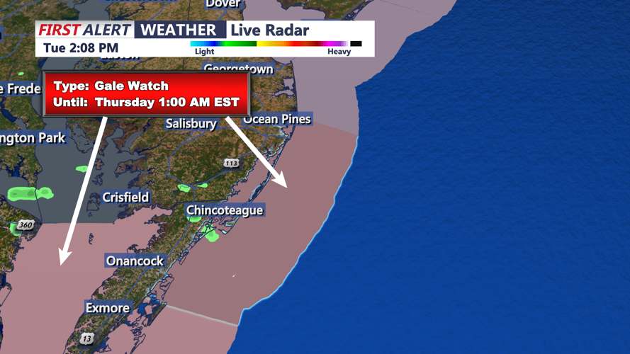
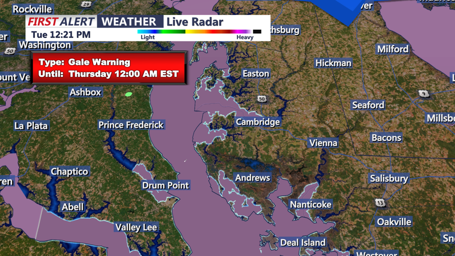
Watches and Warnings
- Coastal Flood Advisory: Areas along the coast may experience minor flooding due to high winds and rain.
- Marginal Risk for Severe Weather: The Storm Prediction Center highlights a low but present risk for strong storms with gusty winds.
- Flood Risk: A marginal risk (1/4) for excessive rainfall could lead to localized flooding in urban and poor drainage areas.
Thursday Forecast
Conditions will improve as high pressure builds into the region. Winds will remain gusty, reaching 25-30 mph, with highs in the low to mid-30s. Wind chills will make it feel 10 degrees colder. Skies will clear Thursday night, with overnight lows dipping into the teens and low 20s across the area.
Residents are urged to monitor updates from the National Weather Service and prepare for wet and windy conditions, especially during the Wednesday commute.