


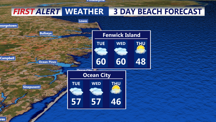
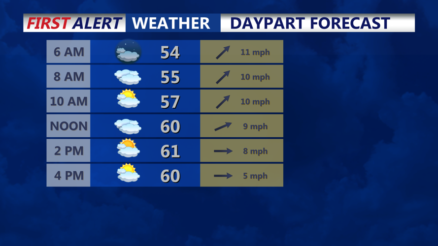

DELMARVA - Low pressure moves east Tuesday morning, allowing rain to clear quickly. However, lingering clouds and a slow-moving cold front will keep skies partly overcast. By midday, conditions will improve, with some sunshine and seasonable highs approaching 60 degrees, especially south of Dover. Coastal and northern areas will remain slightly cooler in the mid-50s. Tuesday night brings clear skies and a return to cooler temperatures as high pressure briefly settles in. Overnight lows will drop into the 30s, about 10 degrees cooler than the previous night but still slightly above seasonal norms.
Wednesday:
Wednesday starts dry, with some sunshine in the morning. However, a new low-pressure system approaches from the southwest, bringing increasing clouds throughout the day. Rain is expected by the afternoon or evening, depending on the system's timing. Highs will be cooler than Tuesday, ranging from the upper 40s to low 50s. Rain continues into Wednesday night as the low-pressure system moves offshore. Despite the wet conditions, temperatures will remain above freezing, ensuring no significant wintry precipitation in the region.
Thursday:
By Thursday, colder air settles in behind Wednesday's low-pressure system. High pressure takes hold, bringing dry and sunny conditions. Temperatures will be closer to seasonal norms, with highs in the mid-40s across the region. Overnight lows will dip below freezing, marking a colder night but still within typical December ranges.
