



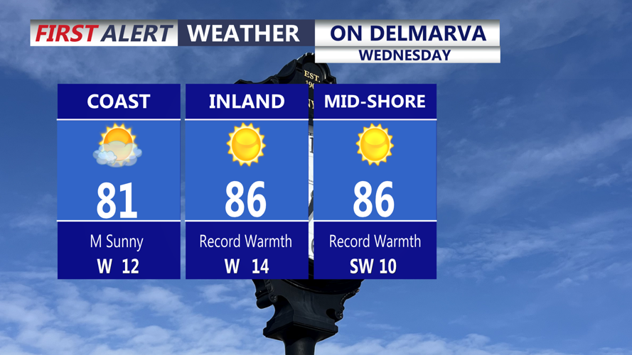
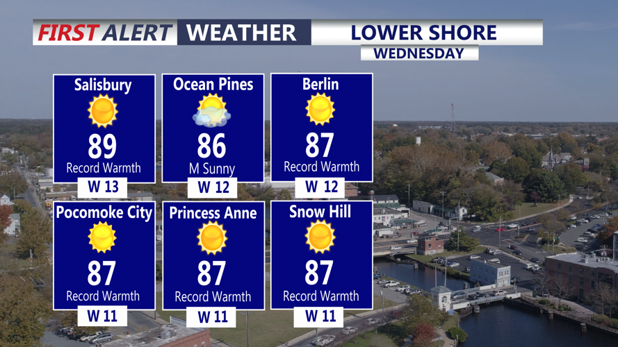
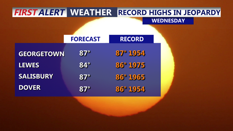


DELMARVA - A surge of summerlike warmth and humidity will dominate the weather Wednesday extending from Lewes and Rehoboth Beach south to Ocean City, Maryland, before a cold front brings cooler conditions overnight.
Wednesday morning will begin with unusually mild temperatures in the 60s under partly sunny skies. Southwest winds will continue to transport warm, increasingly humid air into the region, setting the stage for one of the warmest days of the week.
By Wednesday afternoon, temperatures will climb into the low to mid-80s across much of southern Delaware. Inland communities, including Georgetown, Millsboro and Seaford, could experience highs in the upper 80s, with a few locations approaching 90 degrees.
Along the Atlantic coastline, including Rehoboth Beach, Dewey Beach, Bethany Beach, Fenwick Island and Ocean City, temperatures should generally remain in the upper 70s to lower 80s, with slightly cooler conditions near the ocean.
Increasing humidity will make the afternoon feel even warmer. Dew points climbing into the 60s could push heat index values close to 90 degrees across inland portions of Sussex County.
Clouds will gradually increase throughout Wednesday as a cold front approaches from the west. While a few isolated showers are possible during the afternoon and evening, rain chances remain below 25%, and most communities should experience predominantly dry conditions.
West winds will increase to around 12 to 17 mph during the afternoon, with occasional higher gusts possible, especially near the coastline.
For boaters and beachgoers, Atlantic seas are expected to range from 2 to 4 feet. No marine advisories are indicated through Wednesday, although breezy conditions may produce locally choppy waters.
Wednesday evening will remain relatively mild as the cold front moves across southern Delaware and the Maryland beaches. A stray shower remains possible, but widespread rainfall is not expected with this initial frontal passage.
Behind the front, cooler and less humid air will begin filtering into the region overnight. By early Thursday morning, temperatures should settle into the 50s to lower 60s, bringing some relief from Wednesday's unusual warmth.
Thursday will provide a brief break from the summerlike conditions before a stronger cold front approaches Friday. Showers are expected to become more widespread Friday, with a few thunderstorms possible.
The more dramatic change arrives this weekend, when afternoon temperatures may struggle to climb out of the 50s Saturday and Sunday. Gusty northwest winds Saturday will add to the chill, particularly along the Delaware beaches and Ocean City.
There is also the potential for frost in some inland locations Saturday night if winds diminish sufficiently.
The sharp temperature swing will take the region from near-record warmth Wednesday to weather more typical of late fall by the weekend.
