


DELMARVA - A quiet but active weather transition is underway across Sussex County and the Ocean City, Md., area. Under the influence of high pressure, Tuesday evening should remain calm and seasonable, but by Wednesday night a cold front tracking through the region will usher in a sharper pressure gradient and the potential for very strong winds.
Through Wednesday evening: Late Tuesday will see diminishing winds and clearing skies as high pressure builds in from the south, promoting radiational cooling overnight. Expect low temperatures ranging from the low- to mid-30s in northern parts of the county to the upper-30s or around 40 degrees closer to the coast. Wednesday brings warmer air and increasing southwest winds; most inland highs should climb into the 60s, with gusts possibly reaching 20 to 30 mph late day.
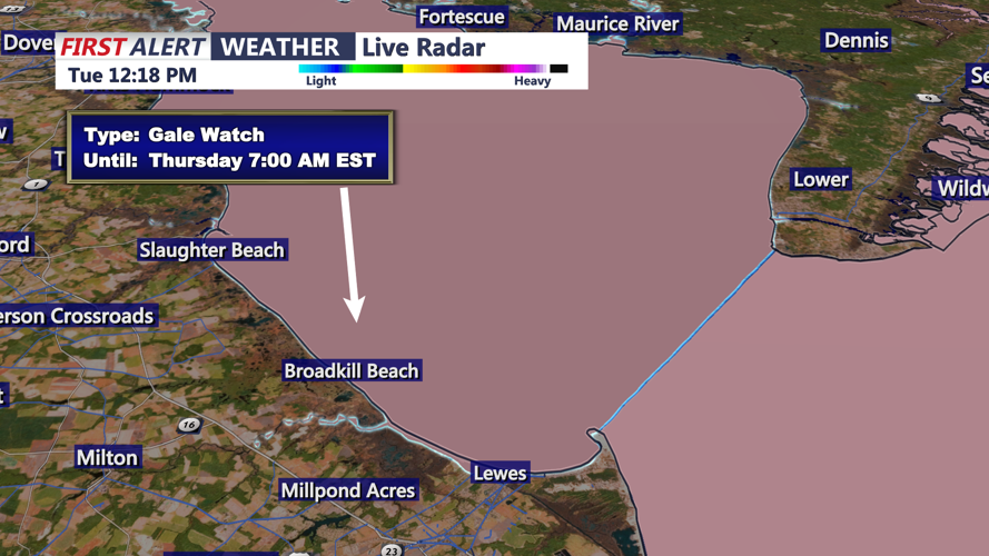
Wednesday night into early Thursday: A low-pressure system passing to the north, combined with a trailing cold front, will tighten the pressure gradient. While widespread thunder is unlikely, brief showers and wind gusts of 45 to 60 mph are possible as stronger winds aloft mix down. The most intense gusts are expected late evening into early Thursday. Overnight lows will fall into the mid-30s northward and around the mid-40s near the coast.
Looking ahead: After the front passes, high pressure will briefly rebuild Thursday night into Friday, offering a short respite. But late Friday into the weekend, another strong low and cold front will move through, marking the start of a fairly active pattern. Rain chances will rise Sunday into Monday along with the potential for the coldest air of the season thus far early next week.