



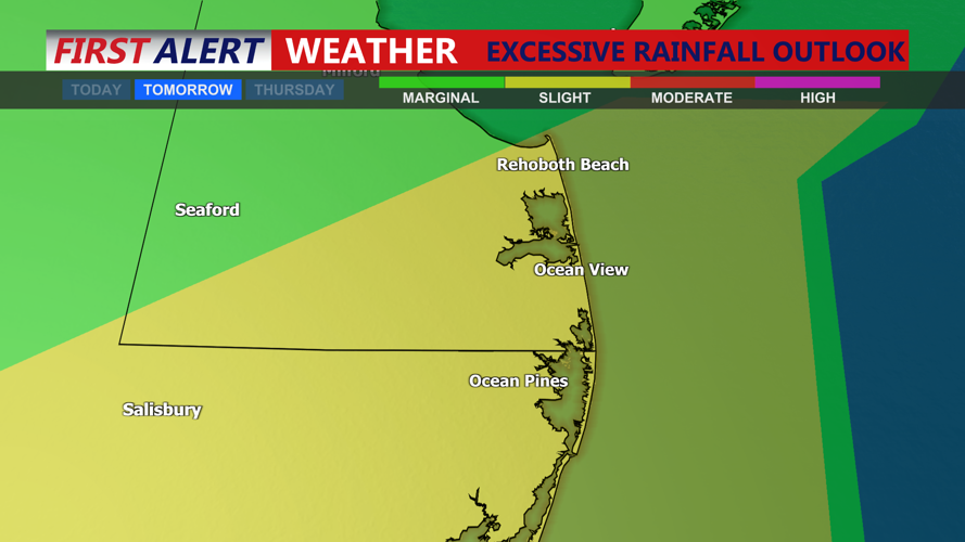

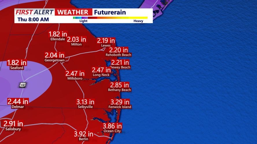
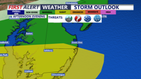

DELMARVA - Another round of showers and thunderstorms could affect Sussex County from early Wednesday morning through Wednesday night as a slow-moving cold front crosses Delmarva.
Scattered showers or storms may already be underway around daybreak Wednesday, with warm and humid conditions continuing through the morning. Storm coverage is expected to increase during the afternoon as daytime heating creates greater instability.
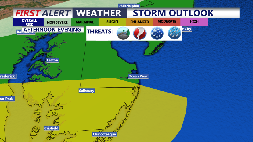
Some thunderstorms could become severe, with damaging straight-line winds the primary threat. Torrential rainfall, frequent lightning and an isolated tornado will also be possible. The strongest storms could quickly produce localized flash flooding, especially along roads, in low-lying communities and in areas with poor drainage.
The severe weather threat is expected to be more localized than Tuesday’s, but Sussex County will remain in one of the more favorable areas for strong storms. Residents and beach visitors should monitor changing weather conditions and be prepared to move indoors when thunder is heard.
High temperatures Wednesday will reach the 80s, with high humidity making conditions feel uncomfortable between storms. Winds will gradually shift as the cold front moves through the region.
Showers and thunderstorms should begin decreasing Wednesday evening and overnight. Conditions are expected to turn quieter by early Thursday morning, with lower humidity and drier weather beginning to move into Sussex County.
