


DELMARVA - Sussex County could see scattered showers and thunderstorms late Thursday evening as a surface trough and weakening cold front move through the region, according to forecasters.
The system, tied to a larger closed low pressure area between the Great Lakes and Hudson Bay, is expected to lose strength as it pushes eastward. Still, forecasters say storms that arrive early in the evening could produce gusty winds, particularly west of Interstate 95, before weakening overnight. Any downpours will bring much-needed rain, though rainfall amounts are expected to remain light across Delmarva.
Overnight lows will stay mild, with temperatures in the low to mid-60s. Areas of low clouds and patchy fog are possible early Friday morning.
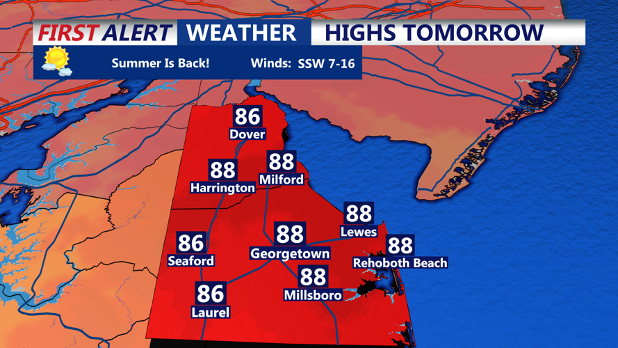
Friday is expected to be warm and humid as the weakening front dissipates over the region. Highs will climb into the mid to upper 80s across Sussex County, forecasters said. While an isolated shower or thunderstorm cannot be ruled out Friday afternoon, most of the area should remain dry. Dew points are forecast to remain elevated, keeping a muggy feel in place through the evening.
Looking ahead, a stronger cold front is expected to approach Friday night into Saturday, bringing a higher chance for widespread showers and thunderstorms before cooler, drier air settles into the region by Sunday.