


DELMARVA - Beachgoers in Sussex County should brace for a turbulent stretch of weather from late Friday into Saturday evening as multiple rounds of thunderstorms, including severe ones, target coastal Delaware.
As night falls, showers and thunderstorms may linger, although activity is expected to diminish gradually. However, fog and mist could form late tonight due to saturated ground and a humid air mass, making for reduced visibility near the coast. Temperatures will stay mild and muggy with overnight lows in the 60s.
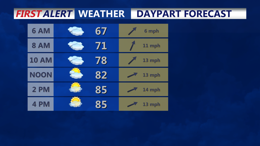
Saturday morning may bring another decaying line of storms, depending on how systems develop over Kentucky and Missouri overnight. This third round could arrive around daybreak, adding to an already soggy start along the beaches. While some showers and storms may push through, partly to mostly cloudy skies are expected through the morning hours.
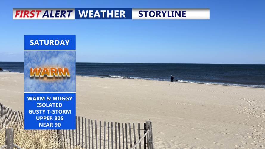
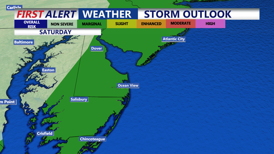
By early afternoon Saturday, skies may begin to clear, with temperatures climbing into the 80s and dew points remaining in the mid-60s—setting the stage for a hot and sticky afternoon. A cold front will approach during the day, triggering isolated to scattered thunderstorms. Although Saturday’s storms may be less widespread, some could still become strong, with gusty winds and hail remaining the main hazards.
By Saturday night, storm chances diminish as the front clears the coast and cooler, drier air filters in.
Sunday promises to be the nicer half of the weekend, with partly to mostly sunny skies, lower humidity, and highs in the 70s. Winds will pick up during the day, with gusts up to 30-35 mph possible before relaxing Sunday night.
Looking ahead, Monday continues the trend of dry and comfortable weather, but another storm system may impact the region midweek with renewed rain chances.