


DELMARVA - Stormy weather is expected to wind down across Sussex County late Tuesday evening as low pressure moves away from the region.
Showers and thunderstorms were expected to continue into the evening before skies turn mostly clear after midnight. Some storms earlier Tuesday carried the risk of damaging wind gusts and heavy rainfall, and a severe thunderstorm watch that included Sussex County expired at 8 p.m.
The strongest storm risk was focused across southern Delmarva and far southern New Jersey, where heavy rain also raised concerns for localized flooding. Conditions should improve overnight as winds turn out of the north at 15 to 20 mph, with gusts up to 30 mph. Lows are expected to fall into the lower 60s.
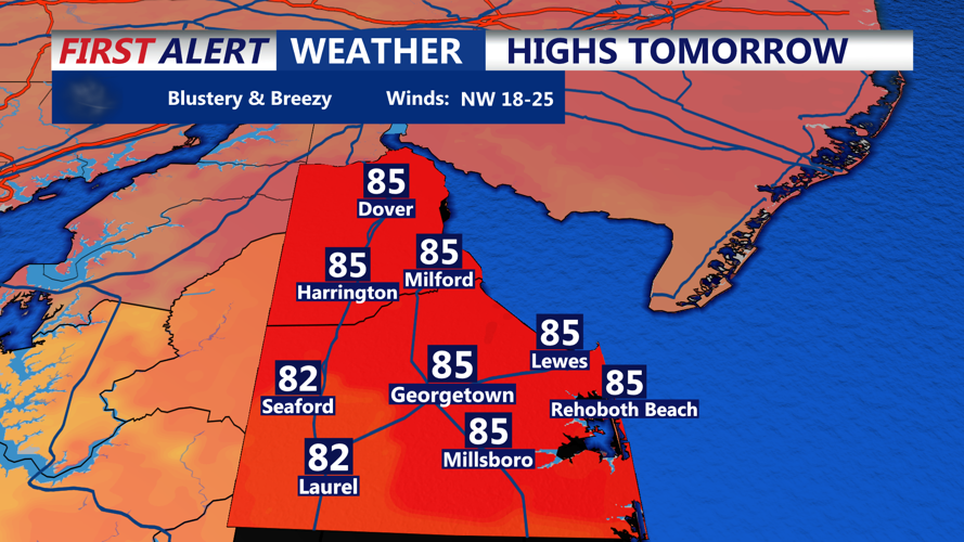
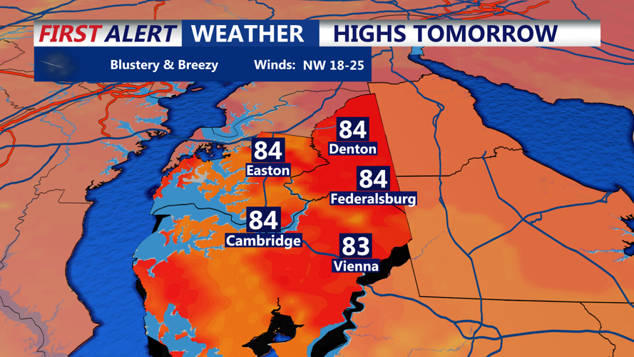
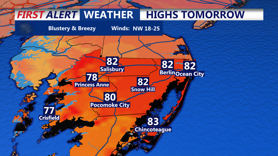
Wednesday is forecast to bring a much calmer pattern. Skies should be sunny, with highs in the mid-80s and northwest winds of 10 to 15 mph.
By late Wednesday evening, Sussex County should remain mostly clear. Temperatures are expected to settle into the mid-60s, with southwest winds around 5 to 10 mph.
More showers and thunderstorms could return late in the week as another cold front approaches the region.
