







DELMARVA - A quiet Monday night will give way to increasingly unsettled weather Tuesday across Sussex County and beach communities from Lewes and Rehoboth Beach south through Bethany Beach, Fenwick Island and Ocean City, Maryland.
Skies will remain mainly dry through late Monday evening. Clouds will gradually increase overnight as warmer and more humid air begins moving northward. An isolated shower or thunderstorm could develop toward daybreak Tuesday.
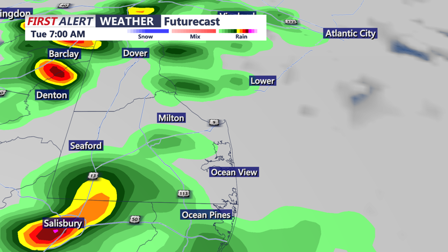
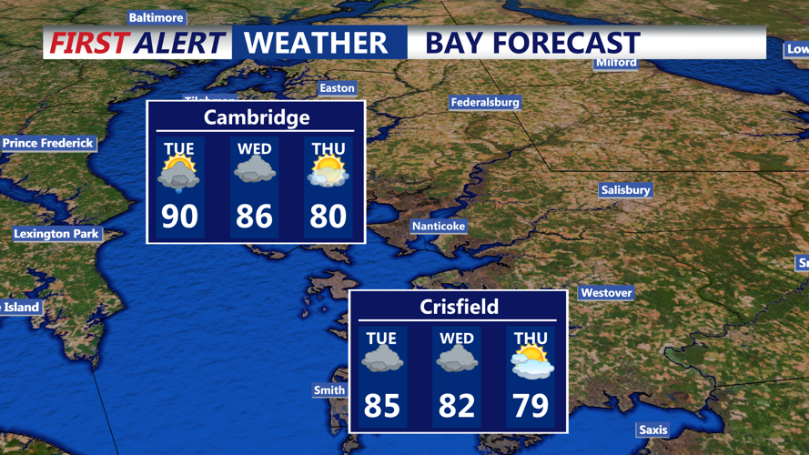
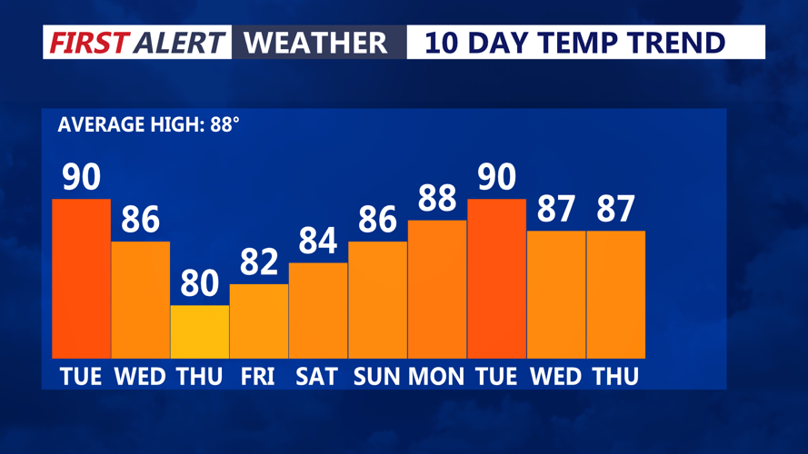
Showers and thunderstorms will become more numerous Tuesday morning as a warm front crosses the region. Southerly winds will push humidity sharply higher, with temperatures climbing into the 80s along the beaches and potentially the upper 80s farther inland.
Several rounds of storms are possible throughout the day. The first could arrive during the morning, followed by more widespread thunderstorms during the afternoon and evening. Another round may develop Tuesday night as a cold front approaches the coast.
The afternoon and evening storms are expected to carry the greatest severe weather threat. Damaging wind gusts will be the primary concern, although frequent lightning and isolated hail also will be possible. Sussex County and Ocean City are under a level 2 out of 5 risk for severe thunderstorms.
Tropical levels of moisture will also allow storms to produce very heavy rainfall. Some locations could receive several inches of rain in a short period, increasing the risk of flash flooding on roads, in low-lying communities and in areas with poor drainage.
Flooding could develop quickly along busy coastal routes, including Delaware Route 1 and Coastal Highway, especially if storms repeatedly move across the same locations. Drivers should never attempt to cross a flooded roadway.
Storms may continue through Tuesday night and into Wednesday morning as the cold front moves through. Conditions should gradually improve later Wednesday, although the exact timing will depend on how quickly the front clears the coast.
