


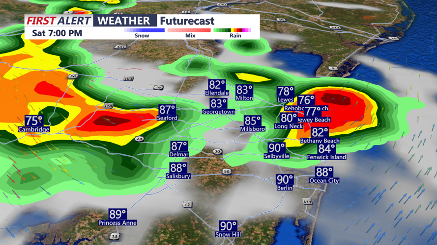


DELMARVA - A volatile holiday weather pattern will continue Saturday afternoon across Sussex County, the Delaware beaches and areas south toward Ocean City, with dangerous heat in place before strong to severe thunderstorms move into the region late in the day.
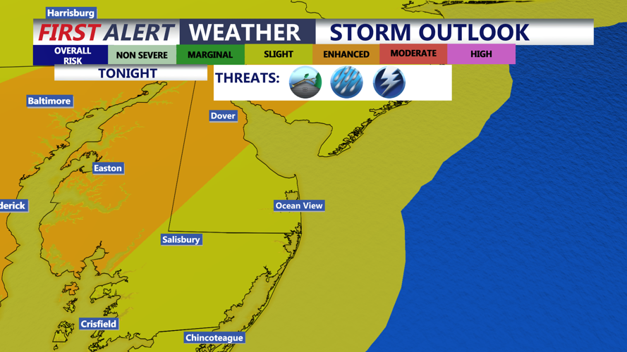
A Severe Thunderstorm Watch is in effect until 11 p.m. for Delaware, including Sussex County, and nearby coastal waters. The watch highlights the potential for scattered damaging winds, isolated significant gusts up to 75 mph and isolated hail up to 1 inch as storms increase in coverage through the afternoon and evening.
The main window for concern across Sussex County and the Delaware beaches runs from about 3 p.m. to 11 p.m., with the highest threat expected later this evening, especially from 7 p.m. to 11 p.m. Storms may develop ahead of the main round, but the more organized activity is expected later in the day. Damaging wind gusts are the primary concern, though torrential downpours could also cause localized flash flooding in poor drainage areas, low-lying roads and spots that see repeated storms.
The storms will move into a hot and unstable air mass after another afternoon of extreme heat. Temperatures have climbed into the mid-90s to around 100 in parts of the region, and an Extreme Heat Warning remains in effect for Delaware until 8 p.m. Even where heat index values have eased somewhat because of mixing, the prolonged nature of the heat continues to create a serious risk for heat-related illness.
Farther south toward Ocean City and the lower Maryland Eastern Shore, the same setup supports a risk of strong to severe storms late Saturday afternoon and evening. Damaging winds, frequent lightning and heavy rain are the main concerns, and storms could disrupt evening Fourth of July plans across the coastal region.
Conditions will not fully settle down after Saturday night. Sunday will bring some relief from the most extreme temperatures, but Delmarva will still be humid, with highs generally in the low 90s and heat index values possibly reaching the mid-90s to low 100s. Additional rounds of showers and thunderstorms are expected Sunday and Monday, with a continued risk for severe weather and flash flooding, especially where storms repeatedly move over the same areas.
The heat should ease more noticeably by Monday as a frontal boundary stalls near the region. That front will keep the forecast unsettled, with more showers and thunderstorms possible into Tuesday before drier weather trends return by midweek.
