


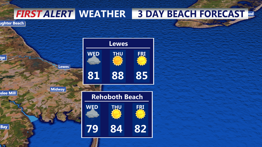

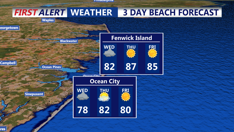

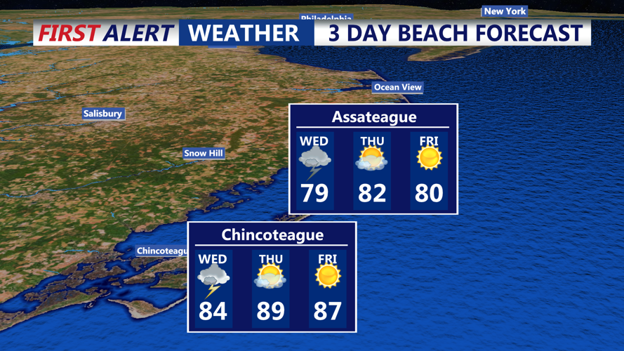

DELMARVA - Sussex County will wake up Wednesday morning to lingering showers and the possibility of isolated thunderstorms as the slow-moving cold front remains draped across the region. Early in the day, clouds will be widespread, and pockets of heavy rain could still impact travel, especially before noon.
As the day progresses, the front will gradually push offshore, allowing drier air to filter into southern Delaware. Skies will begin to clear from west to east during the afternoon hours. By late Wednesday, most of the region should be dry, with only a few residual showers possible near the coast. Temperatures will warm into the low to mid-80s, with the highest readings in areas that see more sunshine later in the day.
Wednesday night will mark a turning point in the weather pattern. High pressure will build in from the west, setting the stage for dry and quiet conditions. Expect overnight lows to settle into the 60s under partly cloudy to clear skies.
Thursday will feature a mix of sun and clouds with seasonably warm temperatures. Highs will reach the mid to upper 80s, providing a more comfortable day compared to the unsettled weather earlier in the week. Although most of Sussex County will stay dry, a weak cold front could slip southward later in the day. This may trigger a stray shower or an isolated thunderstorm, mainly well to the north and west of the county.
Thursday night into early Friday morning will be mainly clear and tranquil. Lows will again dip into the 60s as high pressure strengthens its hold over the Mid-Atlantic.
Overall, residents can expect improving conditions from midweek into early Friday, with drier air and moderating temperatures replacing the recent bouts of rain and storms.
