


Sussex County residents will see summer-like weather return Friday before a cold front brings the potential for strong storms late Saturday.
High pressure offshore continues to pump warmth and humidity into the region, sending afternoon highs into the 80s Friday with dew points climbing into the 60s. Breezy conditions will fade into a mild night, with lows in the 60s inland and near 70 closer to tidal waters and urban areas. Some patchy fog is possible overnight, though it is not expected to be widespread.
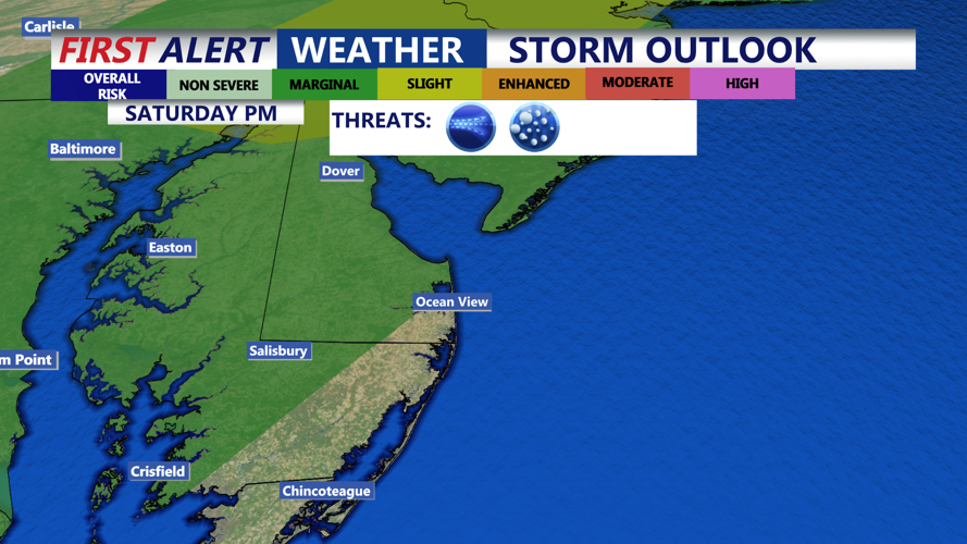
Saturday will begin with sunshine, helping to push temperatures into the upper 80s, with some locations on Delmarva possibly reaching 90 degrees. By afternoon, an approaching cold front and upper-level disturbance will spark widespread showers and thunderstorms. Storms are expected to develop first to the north and west, then spread into Delaware and Maryland’s Eastern Shore through the evening.
Damaging winds are the primary threat, though there is also a small risk for isolated tornadoes. Heavy rainfall is another concern, with rainfall rates of one to two inches per hour possible in the strongest storms. While soils remain relatively dry from recent weather, some localized flooding cannot be ruled out.
The Storm Prediction Center has placed areas northwest of the I-95 corridor under a slight risk for severe storms, with a marginal risk extending across Delmarva. The Weather Prediction Center currently has the region in a marginal risk for excessive rainfall.
Storms should gradually diminish overnight into Sunday as the cold front pushes offshore. Cooler conditions will follow, with highs in the low to mid-70s Sunday and overnight lows dipping into the 50s. Canadian high pressure will then bring clear, dry weather into early next week.
Looking ahead, highs will remain in the 70s much of next week, with lows in the 40s and 50s. A cold front late Thursday into Friday may bring slightly warmer conditions ahead of it, but current guidance suggests little moisture with its passage.