


DELMARVA - Residents and visitors across Sussex County and the Atlantic beaches of the Delmarva Peninsula can expect a stormy start to the period, followed by clearing skies and more comfortable weather as the weekend approaches.
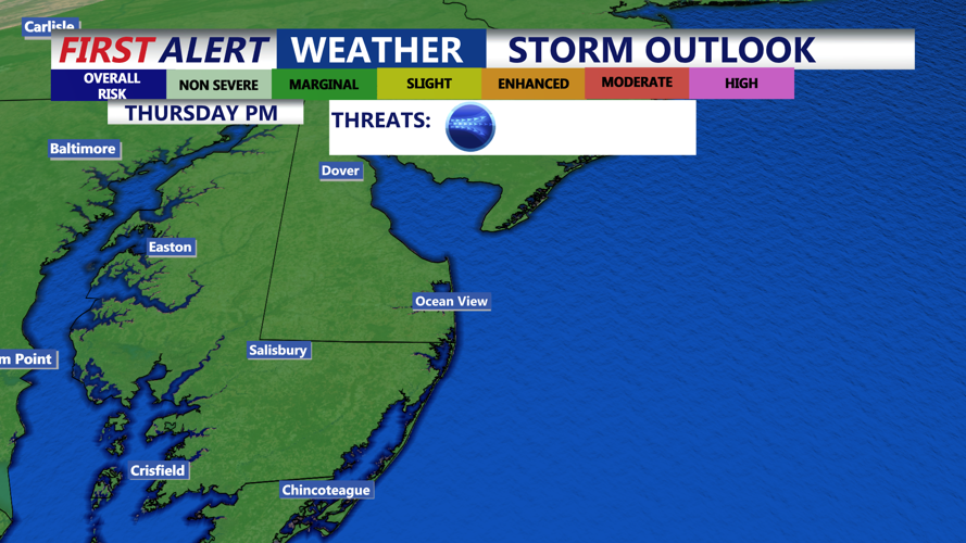
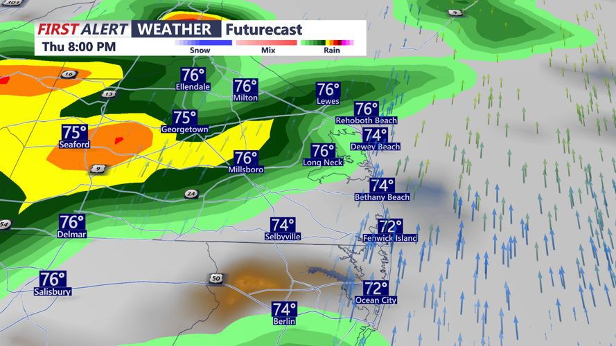
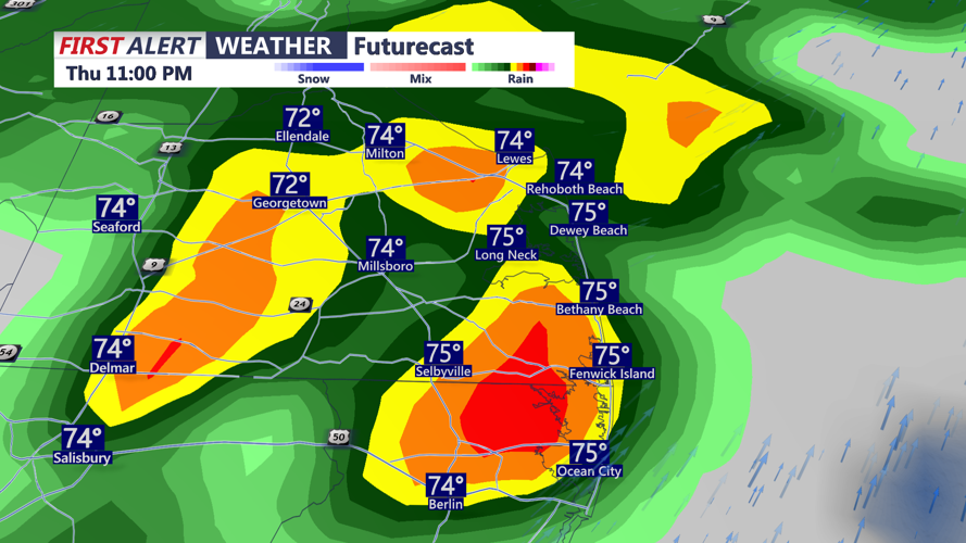
Thursday will begin warm and humid with showers and thunderstorms developing through the morning and intensifying by the afternoon as a cold front approaches. Highs are expected to reach the upper 70s to low 80s, with higher readings possible in southern Delaware where some breaks in the clouds occur. The Storm Prediction Center maintains a marginal risk for severe weather Thursday, with damaging wind gusts the primary concern and a low, conditional risk for an isolated tornado. Rainfall amounts could total 1 to 2 inches, with locally higher amounts possible.
By late Thursday night into early Friday, the cold front will sweep offshore. Scattered showers may linger into Friday morning along the immediate coast, but most of the region will begin to dry out. Highs on Friday will be near the lower 80s with lower humidity, signaling a break from the sticky conditions earlier in the week.
As high pressure builds in from the west on Friday night and Saturday, skies will clear and temperatures will remain seasonably warm. Saturday morning lows will dip into the 60s, while afternoon highs will top out near the low 80s under partly sunny skies. Only a few light, isolated showers are possible along the coast Saturday, but widespread heavy rain is not expected.
This gradual transition marks the return of more settled weather, making early Saturday a good window for outdoor activities across coastal Delaware and Maryland’s Eastern Shore.