


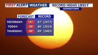


DELMARVA -- The early taste of summer continues in a big way. After Georgetown tied a record high of 87 yesterday, we are well on our way to challenging record highs again this afternoon. High pressure parked over the Atlantic Ocean and a warm front sitting well north of the Mid-Atlantic will keep the warm air firmly in place, helping temperatures soar well above normal.
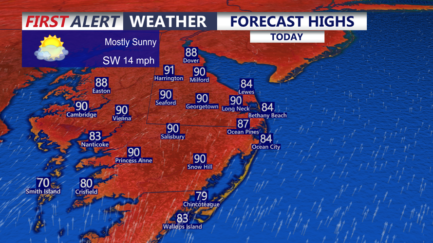
Mostly sunny skies will dominate today, with highs reaching the upper 80s to low 90s. That could bring the first 90-degree reading of the season for some spots. In Georgetown, the record high for today is 86, set in both 1960 and 2024, so that mark is certainly within reach. Southwest winds will continue at 10 to 15 miles per hour, adding to the warm feel.

Highs in the upper 80s to low 90s, cooler along the bay.
Tonight will stay unusually mild for mid-April. Under partly cloudy skies, lows are expected to only fall into the mid to upper 60s. That may be warm enough to challenge the record warm low in Georgetown of 65, set back in 2002.

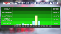
Next chance of rain comes Sunday afternoon/evening with the passage of a cold front.
The heat does not go anywhere Thursday. A mix of sun and clouds will push temperatures back into the upper 80s to near 90. Georgetown’s record high for Thursday is 89, set in 2002, and that could also be tested. Late Thursday night, a weak cold front will slide through the peninsula, but it will not bring much moisture. A stray shower or sprinkle is possible, especially across the northern half of Delmarva.
Behind that front, temperatures do not fall much on Friday. Winds will shift to the west-northwest, and highs will still reach the upper 70s to low and mid 80s under partly cloudy skies.

Looking very nice in Harrington for the DSN Outdoors Expo Friday through Saturday.
