


DELMARVA -- A stretch of cool, breezy weather heading into the weekend, followed by a significant shift as a strong storm system approaches late Sunday.
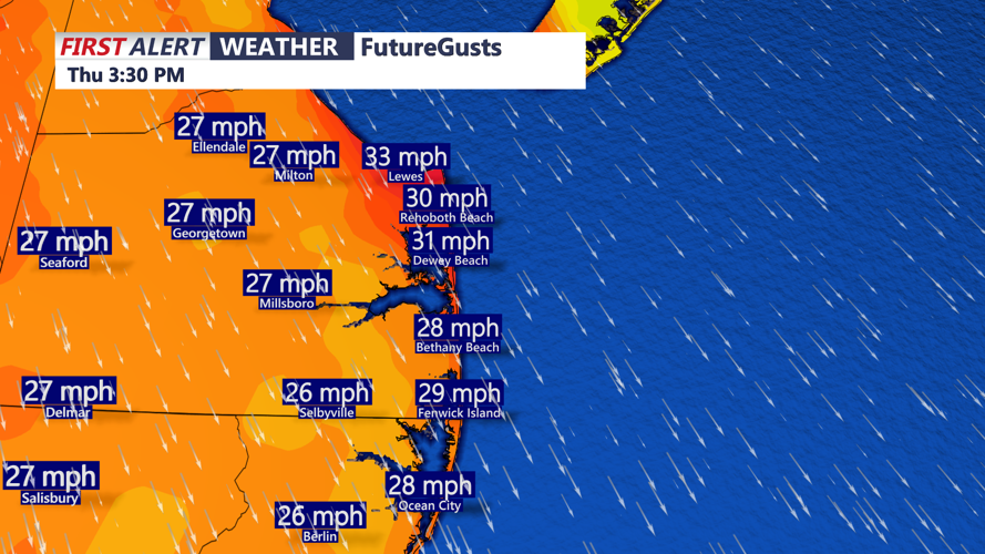
A dome of high pressure over the Great Lakes is pushing into the Mid-Atlantic today, keeping skies clear but delivering brisk northwest winds. Gusts between 25 and 35 mph are likely by afternoon as the system presses against a deepening offshore low near New England.

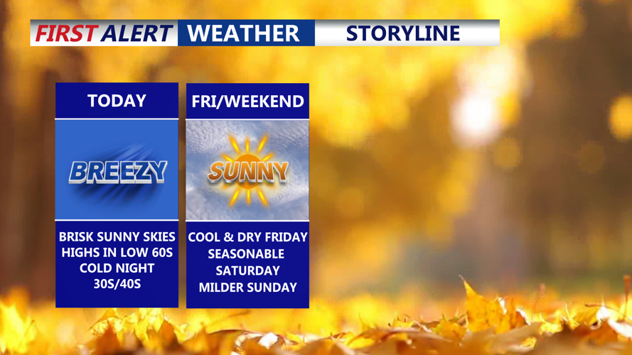
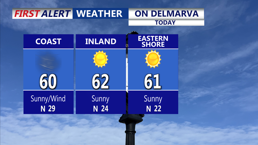
Wall-to-wall sunshine, brisk conditions with highs in the low 60s.
The gusty winds will usher in a cooler, drier air mass, dropping afternoon highs into the upper 50s to low 60s and lowering dew points into the mid-20s and 30s.

Breezy afternoon and evening with gusts 25 to 35 MPH.
Clear skies and a persistent breeze will continue into tonight, with lows dipping into the mid-30s to low 40s. While the breeze should prevent widespread frost, some patchy frost may develop in inland, sheltered areas. Friday remains sunny and cool with highs in the low 60s.

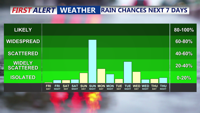
Looking at rain chances returning overnight Sunday-Monday morning.
By Friday night, high pressure will settle more directly over the region, allowing winds to calm and enhancing overnight cooling. If conditions remain clear and calm, frost will become more likely across interior portions of Delmarva.
A subtle pattern change begins Saturday as the high shifts offshore and warmer air begins moving into the area. High temperatures will climb a few degrees higher than Friday in the upper 60s to low 70s, and overnight lows will feel noticeably milder upper 40 to low 50s as moisture and clouds increase ahead of the next weather maker.
A strong cold front is expected to sweep across the region late Sunday into early Monday. Ahead of it, southerly winds will strengthen and temperatures will surge into the 70s Sunday afternoon despite increasing cloud cover. Showers and possibly a few thunderstorms could develop late Sunday, the potential for storms will depend on moisture availability and the timing of the front.
The front will push offshore by early Monday, ushering in cooler and drier conditions once again. A few lingering showers are possible Monday as colder air moves overhead.
Tuesday should feature a return to quieter weather with high pressure briefly building in and temperatures moderating into the mid- to upper 60s. Another cold front may arrive by Wednesday, bringing the next chance of unsettled weather.