



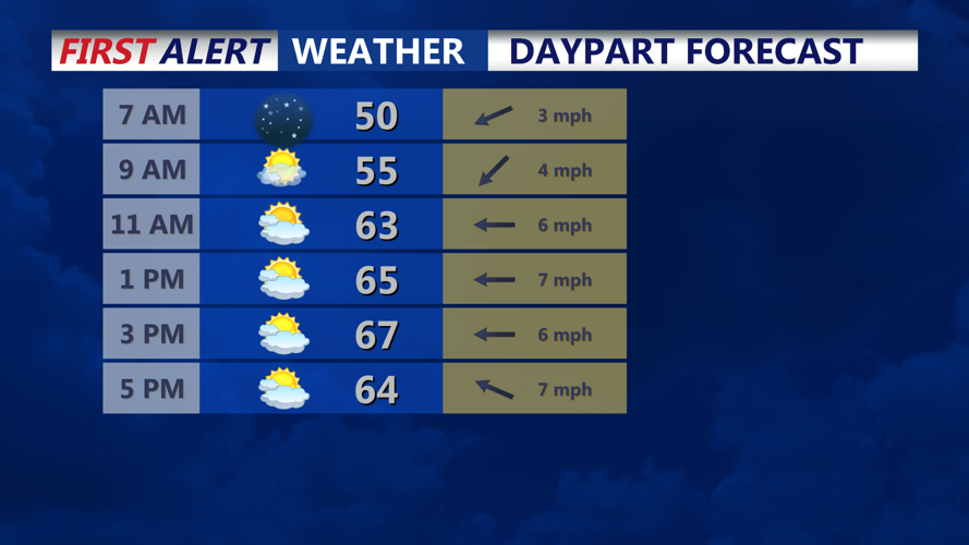


High pressure will keep conditions quiet and dry from early Wednesday morning through early Thursday morning, bringing plenty of sunshine, comfortable afternoon temperatures and another round of chilly overnight weather.
Wednesday morning will begin on a cold note, with temperatures generally in the upper 30s and lower 40s across the region. Inland communities, including Georgetown, Millsboro, Seaford, Laurel, and Salisbury, could experience some of the coldest readings, with temperatures dipping into the mid to upper 30s around sunrise.
Along the coast, locations such as Lewes, Rehoboth Beach, Dewey Beach, Bethany Beach, Fenwick Island, Ocean City, should remain slightly warmer, with morning temperatures mainly in the lower to middle 40s.
Despite the chilly start, widespread frost and freezing conditions are not anticipated. Some isolated patches of fog may develop around sunrise, particularly in low-lying inland areas, but widespread visibility problems are not expected.
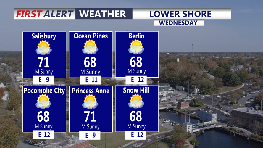
As high pressure settles over New England, skies will remain mostly sunny throughout Wednesday. Afternoon temperatures will climb into the mid to upper 60s, providing pleasant conditions for outdoor activities.
Communities along the Coastal Highway beach corridor can expect comfortable conditions, although a light southeast breeze may keep temperatures slightly cooler near the immediate coastline.
Winds will remain light throughout the day, generally shifting toward the southeast at around 5 mph or less during the afternoon.
Marine conditions will also remain favorable. Atlantic seas are expected to subside to 2 to 3 feet Wednesday, with winds shifting from the northeast to the southeast. No Small Craft Advisories are anticipated.
Wednesday evening will feature mostly clear skies as high pressure continues to dominate the region. Temperatures will fall through the 50s during the evening before settling into the 40s overnight. Some of the colder inland communities could dip into the upper 30s by early Thursday morning.
Looking ahead, the pleasant weather pattern will continue through the remainder of the workweek. Temperatures will gradually warm, with afternoon highs reaching the lower to middle 70s by Thursday and Friday.
A weak cold front is expected to move through the region Friday, but significant rainfall is not anticipated. Cooler temperatures will follow for the weekend, although readings should remain slightly above seasonal averages.
The next meaningful chance for rainfall may arrive Sunday or Monday as an area of low pressure approaches the Mid-Atlantic. The timing and strength of that system remain uncertain.
Until then, residents and visitors can enjoy several days of sunshine, seasonably cool mornings and comfortable afternoons, with no significant weather concerns expected through Saturday.
