


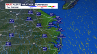


DELMARVA -- After a stretch of gloomy, wet weather, sunshine is back across Delmarva — and it’s here to stay for a few days. A cold front will slide southeast through the region today, but it’s expected to pass without rain and with little added cloud cover. The main change will be a noticeable uptick in winds and a refreshing push of cooler air.

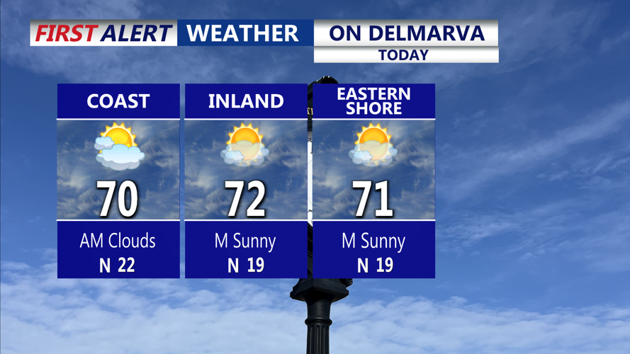
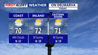
Mostly sunny and breezy afternoon with highs 67 to 73 on the peninsula.
Northwest winds will strengthen through the afternoon behind the front, with gusts reaching 20 to 30 mph. Despite the breeze, temperatures will stay comfortable, topping out in the upper 60s to low 70s. Overnight, skies will remain mostly clear as high pressure builds in from the Great Lakes, allowing temperatures to dip into the low to mid-40s inland and upper 40s to low 50s along the coast. Continued gusts near 20 to 25 mph should prevent frost formation.

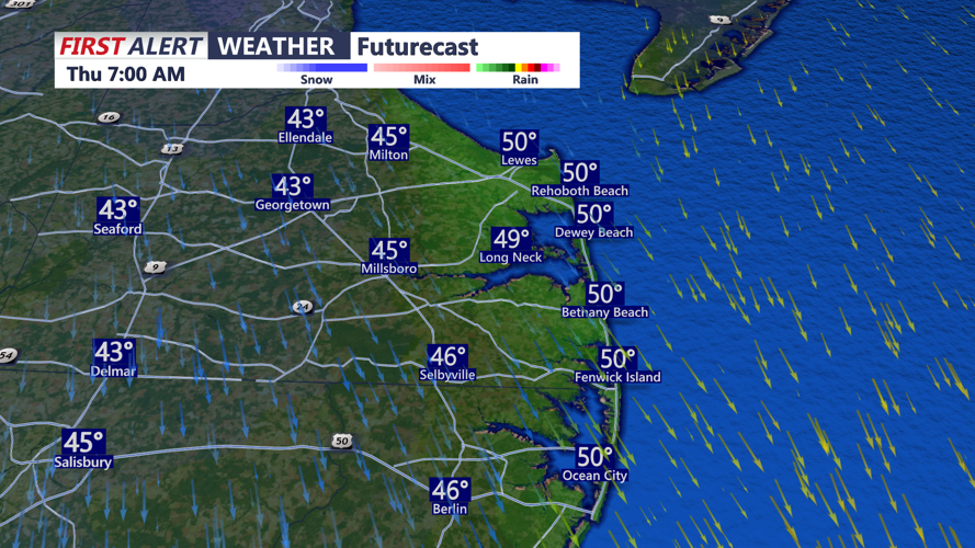
Tonight a clear breezy chilly night falling into the low to mid 40s away from the coast.
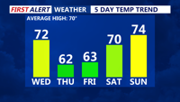
The brisk northwest flow will persist into Thursday under the influence of Canadian high pressure, keeping skies bright and temperatures cooler. Highs Thursday will reach the lower 60s, with overnight lows in the upper 30s to low 40s.

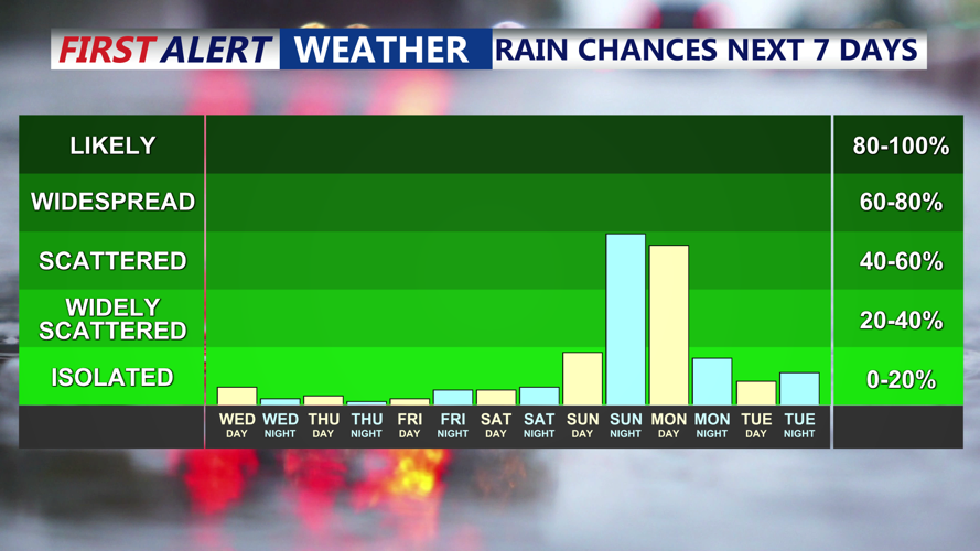
Staying dry through the weekend, rain changes return overnight Sunday-Monday.
Friday will bring more sunshine and slightly warmer conditions, with highs climbing into the low to mid-60s. As the high-pressure system settles overhead Friday night, temperatures will once again drop into the upper 30s to mid-40s.
A subtle warm front will cross the region Saturday, increasing cloud cover but also nudging temperatures higher. Highs will climb into the upper 60s to low 70s, and southerly winds will keep overnight lows mild — in the mid-40s to low 50s.
Sunday is shaping up to be the warmest day of the forecast period, with highs in the low to mid-70s under mostly cloudy skies. Rain is expected to hold off until Sunday night as a low-pressure system approaches from the west.
The system will likely bring widespread rain Monday, especially during the first half of the day, followed by drier conditions and possibly some clearing. Highs Monday will settle in the mid to upper 60s. Lingering clouds and a few showers could persist into Tuesday, though it won’t be a washout, with highs again in the mid to upper 60s.