


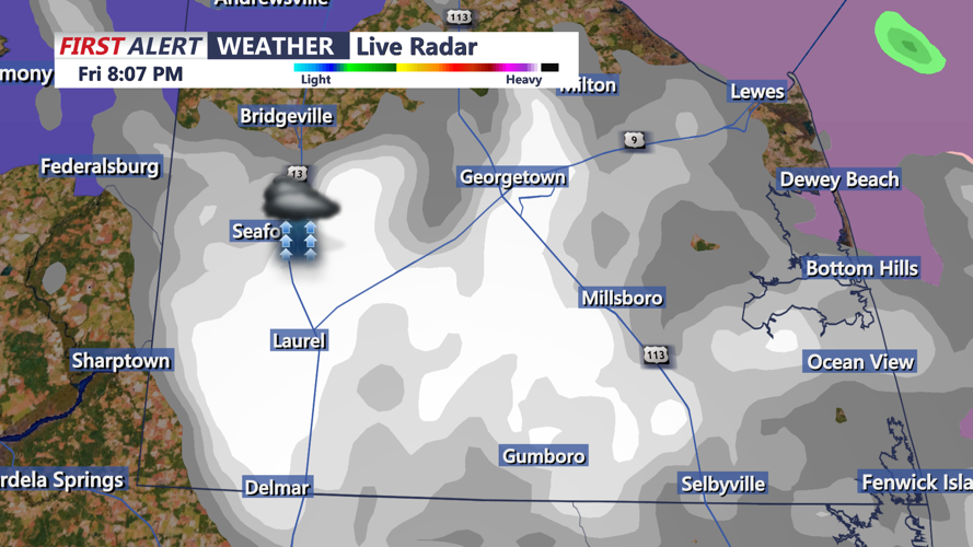


DELMARVA - Light snowfall moved through Sussex County, Delaware, late Friday evening, leaving behind modest accumulations of around an inch or less, according to early reports. As of 6:30 p.m., the snow system was exiting the area, though a few scattered snow showers from central Pennsylvania were still being monitored for possible eastward movement.
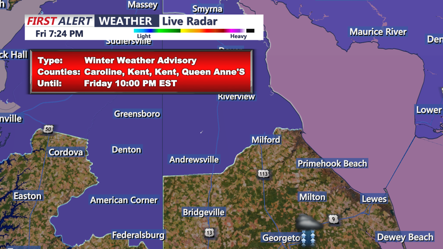
The National Weather Service confirmed the snow's end coincided with the arrival of a strong cold front, which will clear the region by midnight. A winter weather advisory previously in place may be lifted as lingering flurries dissipate.
In the aftermath of the snowfall, Sussex County residents can expect a frigid overnight. Temperatures will dip into the low to mid-20s, with wind chill values plunging into the teens. Cities and towns such as Georgetown, Lewes, Rehoboth Beach, Seaford, and Millsboro will feel the brunt of a sharp northwest wind. Sustained speeds of 15 to 20 mph will be accompanied by gusts reaching 30 to 35 mph.
Saturday will bring continued cold air and brisk winds to the area. High temperatures are forecast to remain in the low to mid-30s, though wind chill values will make it feel much colder, with "feels-like" temperatures in the teens and low 20s. The day will feature passing clouds as strong shortwaves in the upper atmosphere sweep through the Mid-Atlantic region.
While lake-effect snow will remain north of Delaware, areas to the county’s north may see a few flurries by Saturday afternoon. Residents should plan for brisk conditions throughout the day and prepare for the continuation of winter weather impacts.